
 Rock
Rock Aggregate
 Cement
 Concrete
 Soil
Soil Steel
Steel Bitumen/Asphalt
 Security Survey Equipment
 General Items
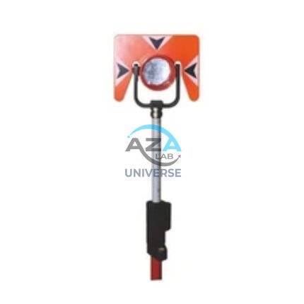

AZA 1037 ALUMINUM TRIPOD
- Lightweight aluminum tripod for field instruments
- Ideal for surveying, mapping, and construction layout
- Extendable legs with quick clamps for easy setup
- Stable base with pointed feet for all terrains
- Compatible with auto levels, total stations, lasers
- Includes shoulder strap or carrying handle
- Adjustable height: typically up to 160 cm
- Durable, rust-resistant design for outdoor use
Description
The Aluminum Tripod from Azalab is a high-precision, field-ready instrument stand, engineered for professionals who demand stability, portability, and durability. Whether you’re working in surveying, construction, mapping, or laser leveling, this tripod delivers a reliable platform for mounting equipment like auto levels, total stations, theodolites, or rotary lasers.
Constructed from high-grade aluminum alloy, the tripod is both lightweight and corrosion-resistant, making it ideal for outdoor conditions including rough terrain, dusty construction sites, or damp environments. It is designed to withstand daily wear and tear while maintaining firm support for high-precision instruments.aluminum tripod, surveying tripod, mapping tripod, laser level stand, adjustable field tripod.
The tripod legs are extendable and feature quick-release clamps, allowing users to easily adjust the height to match specific instrument requirements. Most models offer an adjustable height range from around 90 cm to 160 cm, accommodating both standing and lower-level setups. The legs are finished with pointed feet and anti-slip rubber pads, offering strong grip on soil, gravel, and concrete surfaces.aluminum tripod, surveying tripod, mapping tripod, laser level stand, adjustable field tripod.
A flat or dome-shaped tripod head ensures compatibility with various surveying and mapping devices. The head usually includes a standard 5/8″ x 11 mounting screw, a universal fit for most modern equipment. Whether you’re installing a laser level for aligning walls, a total station for land measurement, or an auto level for elevation checks, this tripod provides the stable base needed for accurate readings.
The Azalab Aluminum Tripod is also appreciated for its portability. Despite its robust design, the tripod weighs only around 3 to 5 kilograms, making it easy to transport between job sites. Most versions include a carrying strap or padded handle, allowing surveyors and technicians to carry it comfortably even over long distances in the field.
Built for professionals but easy enough for students and beginners, this tripod is widely used in surveying fieldwork, civil engineering, geotechnical studies, interior layout marking, and even architectural applications. The quick clamp system ensures rapid setup and take-down, which saves time on active job sites.
Additionally, the tripod’s durability and compact foldability make it a great fit for storage in survey vehicles, classrooms, or tool sheds. It does not require maintenance beyond occasional cleaning and checking of the clamp mechanism, making it a long-lasting, low-fuss piece of equipment.
For optimal use, it’s best to pair this tripod with certified leveling or mapping instruments. For reference and setup guidelines, users can explore technical documents and calibration procedures on resources like trimble.com, topconpositioning.com, or government standards like surveyofindia.gov.in. These guides can help ensure you’re using your tripod-instrument setup to full potential with proper leveling and alignment practices.
In summary, the Azalab Aluminum Tripod is a rugged, field-proven instrument stand suitable for anyone involved in spatial measurement, terrain analysis, or construction layout. With its lightweight build, adjustable features, and universal compatibility, it remains a staple tool for surveyors, engineers, and construction professionals who rely on accurate data collection and instrument stability.
Specifications:
| Feature | Description |
|---|---|
| Material | Anodized aluminum alloy |
| Height Range | Approx. 90 cm – 160 cm (adjustable) |
| Leg Lock System | Quick-release clamps |
| Head Type | Flat or dome, with 5/8″ x 11 thread |
| Feet Design | Pointed metal with rubber base |
| Weight | Approx. 3 – 5 kg |
| Compatibility | Auto levels, total stations, lasers |
| Portability | Carrying handle or shoulder strap |
| Application | Surveying, construction, mapping |
| Finish | Matte or powder-coated anti-corrosion |
Frequently Asked Questions (FAQ):
Q1: What instruments can be mounted on this aluminum tripod?
A: It supports most surveying instruments including auto levels, total stations, theodolites, and laser levels.
Q2: Is it suitable for outdoor use?
A: Yes, the tripod is weather-resistant and stable even on uneven or rough terrain.
Q3: How much weight can the tripod support?
A: It can comfortably support standard surveying and laser instruments weighing up to 5–10 kg.
Q4: Does it come with a carrying case or strap?
A: Most models include a shoulder strap or handle for easy transport.
Q5: Can this tripod be used for educational or student training purposes?
A: Absolutely. It’s widely used in engineering colleges and field training for surveying students.
Additional information
| Material |
Anodized aluminum alloy |
|---|---|
| Height Range |
Approx. 90 cm – 160 cm (adjustable) |
| Leg Lock System |
Quick-release clamps |
| Head Type |
Flat or dome, with 5/8" x 11 thread |
You may also like…
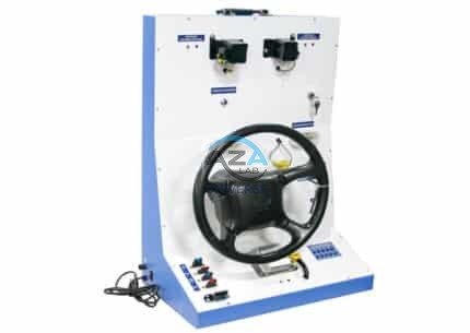
ABS Braking System Training Board Simulator (Model AZA1245)
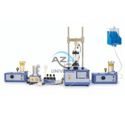
Advanced Triaxial Test System (UU–CU–CD Capable) (AZA 1296)
- UU–CU–CD test modes for complete soil strength profiling
- Automated control of pressure, load, and drainage
- Compatible with clay, silt, sand, and mixed soils
- Integrated data acquisition and real-time graphing
- Meets ASTM D2850, D4767, BS1377, AASHTO standards
- Ideal for geotechnical, research, and academic use
Related products
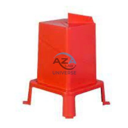
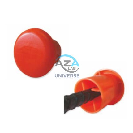
AZA 1024 PROTECTIVE CAPS FOR REBAR, PIPE, BOLTS
- Heavy-duty protective caps for rebar, pipe, and bolts
- Prevents injuries, corrosion, and damage on site
- Bright color enhances site visibility and safety
- Made from durable, weather-resistant plastic or rubber
- Available in multiple sizes and fits securely
- Compliant with OSHA and construction safety standards
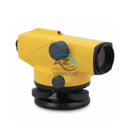
AZA 1031 AUTOMATIC LEVEL
- Auto leveling via magnetic damping compensator
- 24x–32x magnification for long-range visibility
- ±2.5 mm accuracy over 1 km double-run leveling
- Waterproof and dust-resistant rugged design
- Ideal for civil engineering, roads, buildings, and layout
- Easy horizontal angle measurement with 360° scale
- Tripod and leveling staff compatible
- Carrying case and adjustment tools included

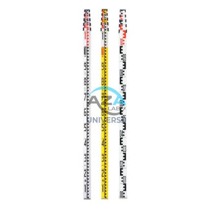
AZA 1034 LEVELLING STAVES
- High-visibility staff for elevation & height measurements
- Telescopic design for easy transport and storage
- Graduated in metric/imperial units for accuracy
- Compatible with all leveling instruments
- Lightweight aluminum or fiberglass construction
- Ideal for civil, land, and construction surveyors
- Lockable sections for stability during use
- Weather-resistant finish for outdoor performance
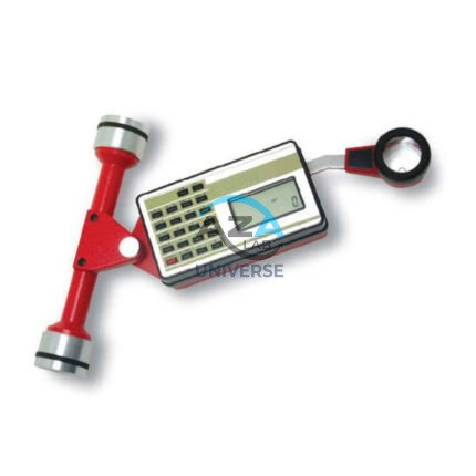
AZA 1040 PLANIMETER
- Precision instrument for measuring 2D area from maps/plans
- Suitable for civil, survey, GIS, & agricultural use
- Available in manual and digital variants
- High accuracy in irregular shape measurement
- Lightweight, compact, and durable build
- Easy-to-read dial or digital display
- Works on paper maps, blueprints, and tracing sheets
- Used by surveyors, engineers, architects, and students
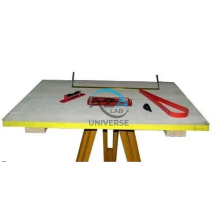
AZA 1044 PLANE TABLE SET
- Complete plane table set for surveying and mapping
- Ideal for topographic work, site planning, and field layout
- Includes drawing board, alidade, tripod & accessories
- Weather-resistant wooden board with smooth surface
- Collapsible, stable tripod stand with adjustable height
- Used by civil engineers, geologists, and students
- Durable and easy to transport
- Compatible with standard drawing sheets and maps

