 Rock
Rock Aggregate
 Cement
 Concrete
 Soil
Soil Steel
Steel Bitumen/Asphalt
 Security Survey Equipment
 General Items

AZA 1034 LEVELLING STAVES
- High-visibility staff for elevation & height measurements
- Telescopic design for easy transport and storage
- Graduated in metric/imperial units for accuracy
- Compatible with all leveling instruments
- Lightweight aluminum or fiberglass construction
- Ideal for civil, land, and construction surveyors
- Lockable sections for stability during use
- Weather-resistant finish for outdoor performance
Description
LEVELLING STAVES
Levelling staves, also known as leveling staffs or survey staffs, are essential tools used alongside leveling instruments like dumpy levels, automatic levels, or laser levels. Their main function is to help surveyors and engineers measure the difference in elevation between two points on the ground, a critical task in construction, topography, and land development.
The Azalab Levelling Staves are crafted with lightweight yet robust materials such as aluminum or fiberglass to ensure durability and ease of use. Each stave is designed with clearly graduated markings, usually in centimeters and meters, or feet and inches, depending on the project requirements. This makes it possible to take precise vertical measurements when viewed through an optical instrument like an auto level.
One of the most notable features of these levelling staves is their telescopic design, which allows them to collapse into compact lengths for easy transportation and storage. Depending on the model, they may extend to 3, 4, or 5 meters, catering to both small-scale and large-scale leveling tasks. Each section locks securely into place, ensuring maximum rigidity during measurement.
Surveyors rely on levelling staves for a wide range of applications, including:
-
Establishing ground elevations before construction begins
-
Verifying excavation depths and fill levels
-
Setting slope gradients in road and drainage construction
-
Marking reference points across large plots of land
Every stave includes bold, weather-resistant markings, often printed in E-style or bar-coded formats. These markings enhance visibility and reduce errors during reading, even in bright sunlight or dusty environments. The high-contrast scale ensures that the readings remain sharp and legible through the leveling instrument’s telescope, which is crucial for accuracy in site conditions.
For digital surveying instruments, bar-coded levelling staffs are compatible with digital levels, allowing the automatic recording of elevation data. This improves both the speed and precision of field measurements while reducing the chance of manual reading errors.
Built with field use in mind, the Azalab levelling staves feature sturdy foot caps and end caps to protect the staff from rough ground contact. The staff can be operated by a single person, often positioned vertically at the point of interest while the observer takes readings from a distant point using a leveling instrument.
To maintain accuracy, regular checks should be conducted to ensure the locking mechanisms remain tight, and the graduations remain legible. Wipe the stave clean after use, especially in muddy or rainy conditions, to prevent wear and ensure a long service life.
Levelling staves are indispensable in:
-
Civil engineering
-
Building layout
-
Agricultural land mapping
-
Water flow studies
-
Road construction
Professionals and students can enhance their understanding of levelling instruments and their applications by referring to educational resources such as nptel.ac.in, surveyequipment.com, or professional guides from equipment manufacturers like Topcon and Leica Geosystems. These platforms offer valuable insights into field setup, error minimization, and proper staff handling.
In conclusion, Azalab’s Levelling Staves are engineered for durability, precision, and ease of use. Whether you’re building a home, developing infrastructure, or conducting topographic studies, these tools deliver the reliable height reference you need for accurate leveling tasks. Their portability and clarity make them an essential part of any surveyor’s toolkit.
Specifications:
| Feature | Specification |
|---|---|
| Material | Aluminum / Fiberglass |
| Length Options | 3 m, 4 m, 5 m (telescopic) |
| Graduations | Metric (cm/m) or Imperial (ft/in) |
| Section Lock | Snap/Clamp locking |
| Barcode Compatibility | Yes (on select models) |
| Folded Length | ~1.2 m to 1.5 m |
| Weight | 1.2 – 2.5 kg (depending on model) |
| Finish | UV-resistant printed scale |
Frequently Asked Questions (FAQ):
Q1: What is the main use of a levelling staff?
A: It is used to measure elevation differences between two points when paired with a leveling instrument.
Q2: Are these staffs suitable for automatic or dumpy levels?
A: Yes, Azalab levelling staves are compatible with all standard leveling instruments.
Q3: Do you offer metric and imperial versions?
A: Yes, both metric and imperial graduated versions are available.
Q4: Can I use these staves in wet or muddy conditions?
A: Yes, they are weather-resistant and easy to clean after use.
Q5: Are bar-coded versions available for digital levels?
A: Yes, select models come with bar-coded scales for use with digital leveling systems.
Additional information
| Material |
Aluminum / Fiberglass |
|---|---|
| Length Options |
3 m, 4 m, 5 m (telescopic) |
| Graduations |
Metric (cm/m) or Imperial (ft/in) |
| Section Lock |
Snap/Clamp locking |
Related products
AZA 1023 IMPALEMENT SAFETY COVERS

AZA 1025 SAFETY HELMET
AZA 1029 TOTAL STATION BUILDER
- High-accuracy electronic total station for construction
- Ideal for layout, leveling, and boundary marking
- Long-range EDM up to 5,000 m with prism
- Dual-axis compensator ensures angle accuracy
- Built-in storage, USB, and Bluetooth options
- Easy-to-read LCD with alphanumeric keypad
- Supports coordinate geometry and stakeout
- Rugged, weatherproof design for field conditions

AZA 1033 AUTOMATIC LEVEL
- Precision leveling instrument for construction & surveying
- Magnetic damping for fast, stable readings
- Reliable optics with 20x–32x magnification options
- Ideal for land survey, building layout & road work
- Built-in compensator for auto horizontal alignment
- Durable, weather-resistant build for field use
- Easy to set up with tripod mount compatibility
- Smooth focusing with fine-tuning adjustment knobs
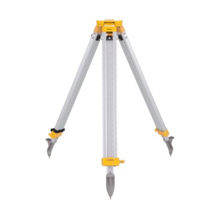
AZA 1037 ALUMINUM TRIPOD
- Lightweight aluminum tripod for field instruments
- Ideal for surveying, mapping, and construction layout
- Extendable legs with quick clamps for easy setup
- Stable base with pointed feet for all terrains
- Compatible with auto levels, total stations, lasers
- Includes shoulder strap or carrying handle
- Adjustable height: typically up to 160 cm
- Durable, rust-resistant design for outdoor use
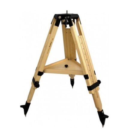
AZA 1038 WOODEN TRIPOD
- Heavy-duty wooden tripod for precise fieldwork
- Excellent stability and minimal vibration
- Ideal for total stations, theodolites, auto levels
- Adjustable legs with locking clamps
- Durable hardwood with weather-resistant coating
- Wide stance and pointed metal feet for grip
- Compatible with 5/8” x 11 thread instruments
- Preferred by surveyors, engineers, geologists

AZA 1039 GPS SYSTEM
- High-precision GPS system for professional use
- Ideal for land survey, GIS, mapping, and navigation
- Real-time positioning with multi-satellite support
- Integrated display and data logging
- Supports GNSS: GPS, GLONASS, Galileo, BeiDou
- Long battery life with rugged, waterproof design
- High signal sensitivity in remote areas
- Compatible with external software and data transfer
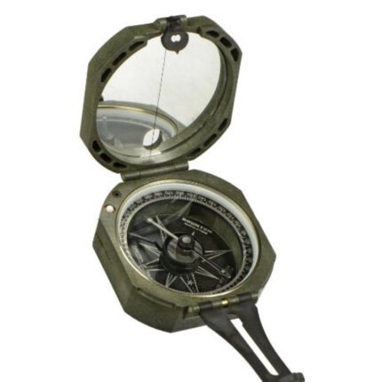
AZA 1042 BRUNTON COMPASS
- Precision magnetic needle with fast settling
- Includes clinometer for measuring angles
- Designed for geologists, surveyors, and engineers
- Rugged aluminum casing with mirror sighting
- Adjustable declination for accurate bearings
- Ideal for structural geology & mapping tasks
- Lightweight, portable, and shock-resistant
- Used widely in academic & fieldwork settings
