
 Rock
Rock Aggregate
 Cement
 Concrete
 Soil
Soil Steel
Steel Bitumen/Asphalt
 Security Survey Equipment
 General Items

AZA 1035 RANGE POLE
- Used for GPS, total station, and alignment in land surveying
- Telescopic, lightweight aluminum or fiberglass build
- Available in multiple section lengths (2m to 5m)
- High-visibility color for long-distance visibility
- Precision tips and bubble levels for accurate positioning
- Compatible with prisms, GPS receivers & targets
- Sturdy locking mechanisms ensure pole stability
- Ideal for boundary marking and control points
Description
A range pole, also known as a survey pole or GPS pole, is an essential tool in modern surveying, construction, and geospatial mapping. The Azalab Range Pole is designed to provide a vertical reference point, ensuring accurate line-of-sight alignment, target positioning, and GPS receiver support in the field. Whether you’re setting boundary lines, conducting topographic surveys, or using a total station or GNSS system, this tool is crucial for accuracy and workflow efficiency.
The Azalab range pole features a robust yet lightweight construction, typically made from aluminum or fiberglass. Its telescopic design allows for adjustable lengths, usually between 2 to 5 meters, with clearly marked graduations for precision in height adjustments. This makes it ideal for both compact and extended setups, adapting to uneven terrain and various instrument heights.
Equipped with durable locking clamps or twist locks, the pole maintains its set height securely during usage, minimizing movement that can impact accuracy. At the base, a stainless steel or pointed metal tip ensures the pole remains stable when placed on soil, asphalt, or rugged ground. A built-in bull’s-eye bubble level is often included near the head for vertical alignment, ensuring the pole stands perpendicular to the survey plane — critical when using GPS receivers or prisms.
Surveyors use range poles with various instruments, such as:
-
Total stations for angular and distance measurement
-
GPS/GNSS receivers for coordinate capture
-
Survey prisms as targets for EDM (Electronic Distance Measurement)
-
Flag markers or targets for line alignment in road and construction layouts
The high-visibility design — often red-white, black-yellow, or red-yellow color schemes — allows clear identification of the pole over long distances, which is crucial in alignment tasks and when tracking targets using optical devices. Some models may come with reflective strips for enhanced visibility in low-light or dusty environments.
Range poles also serve a key role in boundary demarcation, elevation checks, control point staking, and volume surveys. When used in conjunction with a total station, the pole’s position determines the back-sight and fore-sight reference, helping triangulate the precise location of terrain features.
Azalab’s range poles are modular and field-repairable, with replaceable tips and locking segments to extend lifespan. They’re compact when collapsed, making transportation to remote sites convenient. Carrying bags are often included for added protection during transit.
For those using GNSS RTK systems, the range pole ensures the antenna remains at a consistent height for every reading. This reduces vertical error in datasets and increases the confidence level of your georeferenced output.
To deepen your field knowledge or learn best practices for range pole handling, visit educational sources such as gps.gov, leica-geosystems.com, or surveying.org. These platforms offer tutorials on survey workflows, GPS alignment, and pole leveling techniques that can boost your productivity and accuracy.
In conclusion, the Azalab Range Pole is an indispensable tool for engineers, surveyors, and GIS professionals. With features that support alignment, durability, visibility, and precision, it meets the evolving demands of modern fieldwork. Whether you’re conducting land surveys or establishing construction baselines, this pole ensures your data stands tall — both literally and figuratively.
Specifications:
| Feature | Specification |
|---|---|
| Material | Aluminum / Fiberglass |
| Length Range | 2 m – 5 m (telescopic) |
| Sections | 2 to 5 (depending on model) |
| Locking Mechanism | Twist Lock / Flip Clamp |
| Tip Type | Steel / Hardened point |
| Color | Red-white / Yellow-black / Red-yellow |
| Graduation | Metric / Imperial (optional) |
| Level Bubble | Integrated circular bubble |
| Weight | ~1.5 – 2.5 kg |
| Accessory Support | Prism mount / GPS clamp / Target plate |
Frequently Asked Questions (FAQ):
Q1: What is a range pole used for in surveying?
A: A range pole provides a stable and visible vertical reference point for GPS, total stations, and alignment work during surveys.
Q2: Can I attach a GPS receiver or prism to it?
A: Yes, Azalab range poles are compatible with most survey accessories, including GNSS receivers and optical prisms.
Q3: What materials are available?
A: Models are offered in lightweight aluminum or non-conductive fiberglass, depending on your application.
Q4: Is it suitable for use on rough terrain?
A: Yes, the pointed steel tip and sturdy body allow it to stand upright even on uneven or soft ground.
Q5: Does it include a bubble level?
A: Yes, an integrated bubble level ensures your pole remains perfectly vertical during use.
Additional information
| Material |
Aluminum / Fiberglass |
|---|---|
| Length Range |
2 m – 5 m (telescopic) |
| Sections |
2 to 5 (depending on model) |
| Locking Mechanism |
Twist Lock / Flip Clamp |
You may also like…
Related products
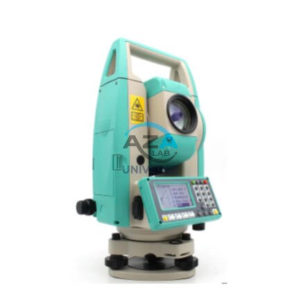
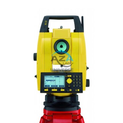
AZA 1029 TOTAL STATION BUILDER
- High-accuracy electronic total station for construction
- Ideal for layout, leveling, and boundary marking
- Long-range EDM up to 5,000 m with prism
- Dual-axis compensator ensures angle accuracy
- Built-in storage, USB, and Bluetooth options
- Easy-to-read LCD with alphanumeric keypad
- Supports coordinate geometry and stakeout
- Rugged, weatherproof design for field conditions
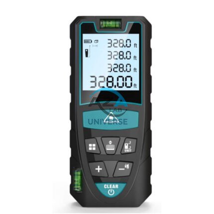
AZA 1030 LASER DISTANCE METER
- Instant digital measurement up to 100 meters
- Accurate to ±1.5 mm with fast response time
- Measures distance, area, volume, and Pythagorean
- Backlit LCD for easy viewing indoors/outdoors
- Compact, pocket-sized, and rechargeable
- Ideal for builders, surveyors, and interior designers
- Stores multiple readings with memory function
- Durable, dustproof, and splash-resistant
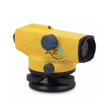
AZA 1031 AUTOMATIC LEVEL
- Auto leveling via magnetic damping compensator
- 24x–32x magnification for long-range visibility
- ±2.5 mm accuracy over 1 km double-run leveling
- Waterproof and dust-resistant rugged design
- Ideal for civil engineering, roads, buildings, and layout
- Easy horizontal angle measurement with 360° scale
- Tripod and leveling staff compatible
- Carrying case and adjustment tools included
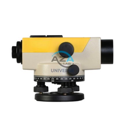
AZA 1033 AUTOMATIC LEVEL
- Precision leveling instrument for construction & surveying
- Magnetic damping for fast, stable readings
- Reliable optics with 20x–32x magnification options
- Ideal for land survey, building layout & road work
- Built-in compensator for auto horizontal alignment
- Durable, weather-resistant build for field use
- Easy to set up with tripod mount compatibility
- Smooth focusing with fine-tuning adjustment knobs
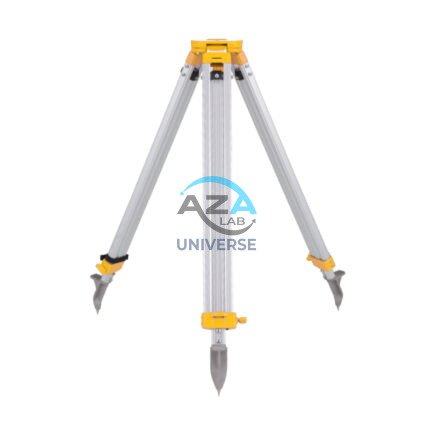
AZA 1037 ALUMINUM TRIPOD
- Lightweight aluminum tripod for field instruments
- Ideal for surveying, mapping, and construction layout
- Extendable legs with quick clamps for easy setup
- Stable base with pointed feet for all terrains
- Compatible with auto levels, total stations, lasers
- Includes shoulder strap or carrying handle
- Adjustable height: typically up to 160 cm
- Durable, rust-resistant design for outdoor use

