
 Rock
Rock Aggregate
 Cement
 Concrete
 Soil
Soil Steel
Steel Bitumen/Asphalt
 Security Survey Equipment
 General Items
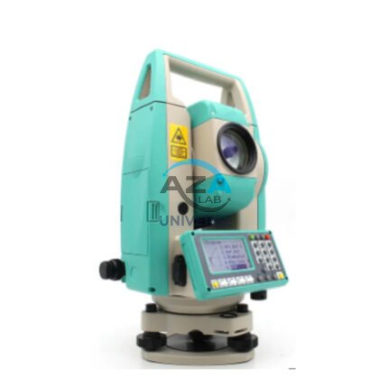
AZA 1029 TOTAL STATION BUILDER
- High-accuracy electronic total station for construction
- Ideal for layout, leveling, and boundary marking
- Long-range EDM up to 5,000 m with prism
- Dual-axis compensator ensures angle accuracy
- Built-in storage, USB, and Bluetooth options
- Easy-to-read LCD with alphanumeric keypad
- Supports coordinate geometry and stakeout
- Rugged, weatherproof design for field conditions
Description
A Total Station Builder is a must-have instrument in the toolkit of civil engineers, surveyors, and construction professionals. Designed for site layout, topographic surveying, and leveling tasks, this advanced total station integrates an electronic theodolite, electronic distance measurement (EDM), and data processing software into one compact and powerful system.
The Azalab Total Station Builder delivers exceptional angular accuracy and long-range measurement capability, enabling fast, precise positioning even on challenging terrains. With a prism mode range of up to 5,000 meters, it allows users to perform control point establishment, grid layout, building foundation setting, and more with pinpoint reliability.total station builder, site layout total station, construction survey instrument, topographic leveling tool, digital surveying equipment.
This total station features an EDM module capable of both prism and reflectorless measurements. In reflectorless mode, it can target surfaces up to 500 meters, ideal for inaccessible or hazardous areas. Measurement readings appear instantly on a dual-sided LCD display, which includes a backlit alphanumeric keypad for easy navigation and data entry.
The dual-axis compensator ensures angular measurements are corrected for tilt, even if the instrument is not perfectly level. Combined with high-precision servos and angular encoders (typically 2″ or 5″ accuracy), the system eliminates common field errors and boosts reliability during tasks such as stakeout, leveling, or resection.
For construction layouts, this total station simplifies workflows by allowing direct coordinate input, distance offsetting, and automatic stakeout guidance. The instrument stores thousands of measurement points and supports USB, SD card, and Bluetooth data transfer, making it easy to export field data for CAD, GIS, or BIM integration.
The total station is pre-loaded with survey software functions like:
-
Point-to-point measurement
-
Area calculation
-
Coordinate geometry (COGO)
-
Missing line measurement
-
Resection and traversing
This makes it suitable for:
-
Topographic mapping
-
Road and bridge layout
-
Land parcel demarcation
-
Utility grid staking
-
Architectural alignment
In terms of durability, the Azalab Total Station Builder features IP65 or higher ingress protection, ensuring resistance against dust, light rain, and humidity. The chassis is shock-resistant, with sealed compartments protecting internal optics and circuits. It also includes a long-lasting rechargeable battery, offering up to 16 hours of field operation per charge — ideal for long survey days.
The total station is mounted on a standard 5/8-inch thread aluminum or wooden tripod, and a plumb bob or laser plummet ensures accurate setup. Optional accessories include a data collector, external GPS receiver, or field controller.
Professionals looking to expand their understanding of total station applications can refer to leica-geosystems.com, topconpositioning.com, or the National Geodetic Survey (NGS).
With exceptional accuracy, user-friendly interface, and multi-application utility, the Azalab Total Station Builder is the ultimate solution for engineers, surveyors, and construction site planners seeking efficiency, durability, and precision in the field.
Specifications:
| Feature | Specification |
|---|---|
| Measuring Range (Prism) | Up to 5,000 m |
| Reflectorless Range | Up to 500 m |
| Angle Accuracy | 2″ or 5″ (depends on model) |
| Distance Accuracy | ±(2 mm + 2 ppm) |
| Display | Dual LCD, backlit with keypad |
| Data Storage | 20,000+ points, USB, SD, Bluetooth |
| Battery Life | Up to 16 hours |
| Weight | 5.5 – 6.5 kg (with battery) |
| Software Functions | Stakeout, COGO, Resection, Area Calc |
| IP Rating | IP65 (dust/water resistant) |
Frequently Asked Questions (FAQ):
Q1: What is a total station used for in construction?
A: It is used for layout, leveling, alignment, and precise point positioning using EDM and angular measurement.
Q2: Can the total station operate without a prism?
A: Yes, in reflectorless mode it can measure up to 500 m without a prism.
Q3: How is data transferred from the instrument?
A: Via USB, SD card, or Bluetooth, compatible with survey software and CAD tools.
Q4: Is it weatherproof?
A: Yes, the unit is IP65-rated and suitable for outdoor environments.
Q5: Can beginners operate the total station easily?
A: Yes, the interface is intuitive, and it includes user guidance for layout and measurement tasks.
Additional information
| Measuring Range (Prism) |
Up to 5,000 m |
|---|---|
| Reflectorless Range |
Up to 500 m |
| Angle Accuracy |
2" or 5" (depends on model) |
| Distance Accuracy |
±(2 mm + 2 ppm) |
You may also like…
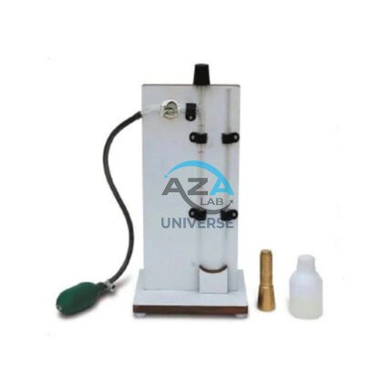
AZA 0799 VOLUME CHANGE APPARATUS
- Precision apparatus for measuring soil volume change
- Ideal for CD and CU triaxial testing
- Manual and digital versions available
- Durable lab-grade stainless steel build
- Fully compliant with IS and ASTM standards
- Provided with all necessary accessories
- Backed by Azalab’s quality assurance and support

AZA 0802 DIGITAL BLAINE AIR PERMEABILITY APPARATUS
- Digital model for precise fineness testing
- Measures surface area in cm²/g (1500–6000 range)
- Complies with IS 4031 Part 2 and ASTM C204
- Built-in vacuum pump with digital timer
- Ideal for cement QC, R&D, and educational labs
- Includes calibration certificate & accessories
Related products
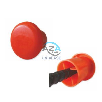
AZA 1024 PROTECTIVE CAPS FOR REBAR, PIPE, BOLTS
- Heavy-duty protective caps for rebar, pipe, and bolts
- Prevents injuries, corrosion, and damage on site
- Bright color enhances site visibility and safety
- Made from durable, weather-resistant plastic or rubber
- Available in multiple sizes and fits securely
- Compliant with OSHA and construction safety standards
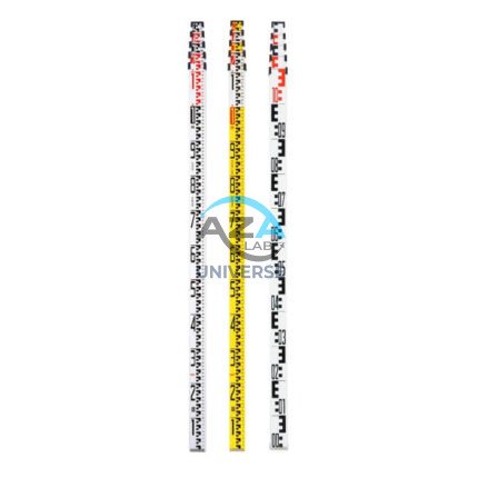
AZA 1034 LEVELLING STAVES
- High-visibility staff for elevation & height measurements
- Telescopic design for easy transport and storage
- Graduated in metric/imperial units for accuracy
- Compatible with all leveling instruments
- Lightweight aluminum or fiberglass construction
- Ideal for civil, land, and construction surveyors
- Lockable sections for stability during use
- Weather-resistant finish for outdoor performance
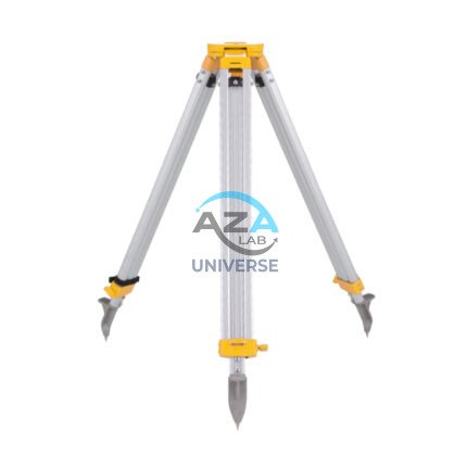
AZA 1037 ALUMINUM TRIPOD
- Lightweight aluminum tripod for field instruments
- Ideal for surveying, mapping, and construction layout
- Extendable legs with quick clamps for easy setup
- Stable base with pointed feet for all terrains
- Compatible with auto levels, total stations, lasers
- Includes shoulder strap or carrying handle
- Adjustable height: typically up to 160 cm
- Durable, rust-resistant design for outdoor use
AZA 1040 PLANIMETER
- Precision instrument for measuring 2D area from maps/plans
- Suitable for civil, survey, GIS, & agricultural use
- Available in manual and digital variants
- High accuracy in irregular shape measurement
- Lightweight, compact, and durable build
- Easy-to-read dial or digital display
- Works on paper maps, blueprints, and tracing sheets
- Used by surveyors, engineers, architects, and students
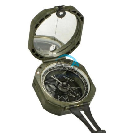
AZA 1042 BRUNTON COMPASS
- Precision magnetic needle with fast settling
- Includes clinometer for measuring angles
- Designed for geologists, surveyors, and engineers
- Rugged aluminum casing with mirror sighting
- Adjustable declination for accurate bearings
- Ideal for structural geology & mapping tasks
- Lightweight, portable, and shock-resistant
- Used widely in academic & fieldwork settings
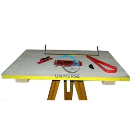
AZA 1044 PLANE TABLE SET
- Complete plane table set for surveying and mapping
- Ideal for topographic work, site planning, and field layout
- Includes drawing board, alidade, tripod & accessories
- Weather-resistant wooden board with smooth surface
- Collapsible, stable tripod stand with adjustable height
- Used by civil engineers, geologists, and students
- Durable and easy to transport
- Compatible with standard drawing sheets and maps