
 Rock
Rock Aggregate
 Cement
 Concrete
 Soil
Soil Steel
Steel Bitumen/Asphalt
 Security Survey Equipment
 General Items
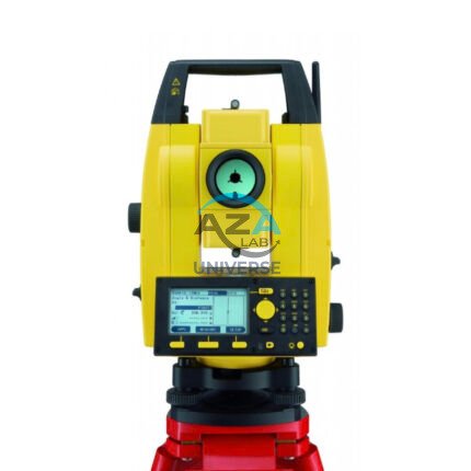
AZA 1028 TOTAL STATION
- Measures distance, angle, and coordinates precisely
- Combines EDM and theodolite in one unit
- Touchscreen with onboard data storage
- Bluetooth, USB, and SD card support
- Ideal for construction, GIS, and land surveys
- Long battery life and weather-resistant build
Description
The Total Station is a revolutionary surveying instrument that merges the functionality of an electronic theodolite, electronic distance measurement (EDM) system, and data recorder into one advanced tool. Available at Azalab, this high-performance device provides fast and accurate measurements of horizontal angles, vertical angles, and distances, making it indispensable for civil engineers, construction firms, land surveyors, and GIS professionals.
High-Precision Distance and Angle Measurement
With a built-in EDM system, the total station offers millimeter-level accuracy in distance measurement over ranges exceeding 1,000 meters using prisms, and up to 500 meters reflectorless. It calculates 3D coordinates (X, Y, Z) instantly, reducing field time and manual error.
Measurement Modes:
-
Single and continuous angle reading
-
Reflectorless and prism-based distance measurement
-
Coordinate and stakeout mode
-
Remote elevation and missing line functions
These capabilities make it a perfect solution for:
-
Site layout & topographic mapping
-
Road, tunnel & railway alignment
-
Utility mapping & structural monitoring
User-Friendly Interface
Modern total stations feature graphical touchscreens, alphanumeric keyboards, and easy-to-navigate software. The Azalab model provides:
-
A color touchscreen interface
-
Guided workflows for layout & topography
-
Internal storage and SD card/USB slots
-
Real-time Bluetooth or Wi-Fi connectivity
Surveyors can save points, perform calculations, and transfer files directly to CAD/GIS platforms via USB or Bluetooth. This enables seamless integration with back-office software like AutoCAD, QGIS, and other mapping tools.
Data Logging & Transfer
The instrument includes:
-
Internal memory (10,000–50,000 points)
-
SD card support
-
USB port & Bluetooth for fast data export
-
Support for common file formats (CSV, DXF, TXT)
Field data is easily retrievable and compatible with surveying and mapping software used in both government and private sectors.
Built to Last
Field conditions can be harsh, but the Azalab Total Station is designed to withstand dust, water, and temperature variations. It typically comes with:
-
IP55/IP66 rating for dust and water resistance
-
A long-life rechargeable Li-ion battery (8–16 hrs)
-
A durable outer casing with an ergonomic handle
This ensures consistent performance whether you’re mapping highways in blazing heat or doing layout work in humid, rainy zones.
Application Areas
This all-in-one device is suited for multiple professional scenarios:
-
Land subdivision and boundary surveys
-
Construction layout and alignment
-
Mining and geological exploration
-
Topographic data collection
-
Utility corridor & telecom tower planning
-
Hydrographic & environmental monitoring
Educational institutes offering diploma and degree programs in civil engineering, surveying, and geoinformatics also prefer the total station for practical labs.
To understand calibration norms and accuracy classes, you can visit iso.org or check local standards at surveyofindia.gov.in.
Specifications:
| Feature | Specification |
|---|---|
| Distance Accuracy (Prism) | ±(2mm + 2ppm) |
| Distance Accuracy (No Prism) | ±(3mm + 2ppm) |
| Angle Measurement Accuracy | 2″ to 5″ seconds |
| Telescope Magnification | 30x |
| Display | Dual-face touchscreen or LCD |
| Data Storage | 10,000 to 50,000 points |
| Connectivity | USB, SD card, Bluetooth, RS-232 |
| Battery Backup | 8 to 16 hours (Li-ion rechargeable) |
| Environmental Protection | IP55 or IP66 |
| Weight | 5–6 kg (with battery & tribrach) |
Frequently Asked Questions (FAQ):
Q1: What does a total station measure?
A: It measures horizontal/vertical angles, slope distances, and calculates X, Y, Z coordinates.
Q2: Is a prism required for measurement?
A: No. It supports reflectorless mode for short-range tasks and prism mode for longer distances.
Q3: Can data be exported to AutoCAD?
A: Yes. Files can be exported in CSV or DXF format for use in AutoCAD and GIS software.
Q4: Does it work in low light or rainy conditions?
A: Yes. With IP-rated protection and backlit display, it operates efficiently in all environments.
Q5: Is it suitable for educational use?
A: Absolutely. Many engineering colleges and polytechnics use total stations for surveying lab work and training.
Additional information
| Distance Accuracy (Prism) |
±(2mm + 2ppm) |
|---|---|
| Distance Accuracy (No Prism) |
±(3mm + 2ppm) |
| Angle Measurement Accuracy |
2" to 5" seconds |
| Telescope Magnification |
30x |
Related products
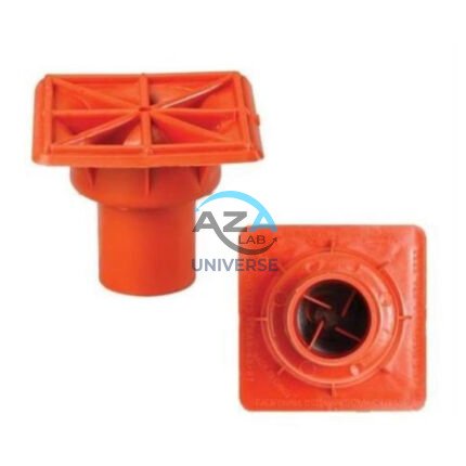
AZA 1024 PROTECTIVE CAPS FOR REBAR, PIPE, BOLTS
- Heavy-duty protective caps for rebar, pipe, and bolts
- Prevents injuries, corrosion, and damage on site
- Bright color enhances site visibility and safety
- Made from durable, weather-resistant plastic or rubber
- Available in multiple sizes and fits securely
- Compliant with OSHA and construction safety standards
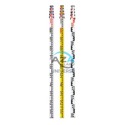
AZA 1034 LEVELLING STAVES
- High-visibility staff for elevation & height measurements
- Telescopic design for easy transport and storage
- Graduated in metric/imperial units for accuracy
- Compatible with all leveling instruments
- Lightweight aluminum or fiberglass construction
- Ideal for civil, land, and construction surveyors
- Lockable sections for stability during use
- Weather-resistant finish for outdoor performance
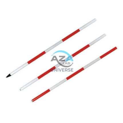
AZA 1035 RANGE POLE
- Used for GPS, total station, and alignment in land surveying
- Telescopic, lightweight aluminum or fiberglass build
- Available in multiple section lengths (2m to 5m)
- High-visibility color for long-distance visibility
- Precision tips and bubble levels for accurate positioning
- Compatible with prisms, GPS receivers & targets
- Sturdy locking mechanisms ensure pole stability
- Ideal for boundary marking and control points
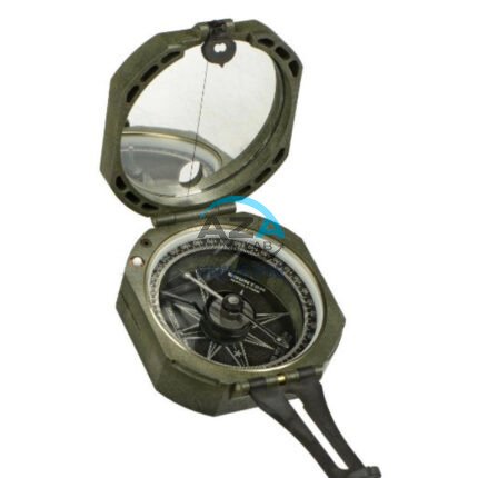
AZA 1042 BRUNTON COMPASS
- Precision magnetic needle with fast settling
- Includes clinometer for measuring angles
- Designed for geologists, surveyors, and engineers
- Rugged aluminum casing with mirror sighting
- Adjustable declination for accurate bearings
- Ideal for structural geology & mapping tasks
- Lightweight, portable, and shock-resistant
- Used widely in academic & fieldwork settings

