
 Rock
Rock Aggregate
 Cement
 Concrete
 Soil
Soil Steel
Steel Bitumen/Asphalt
 Security Survey Equipment
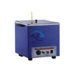 General Items
")
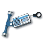
GPS SYSTEM AZA1039
AZA1039 GPS System (Professional GNSS Surveying Receiver)
The AZA1039 GPS System from Azalab is a high-performance, field-grade GNSS positioning solution engineered for land surveying, GIS mapping, construction layout, and geospatial data collection. Designed to deliver reliable accuracy in challenging environments, this system combines multi-constellation satellite tracking, real-time corrections, and rugged field durability.
Advanced Multi-Constellation GNSS Accuracy
Modern surveying demands precision beyond consumer-grade navigation devices. The AZA1039 utilizes multi-band GNSS technology, tracking multiple satellite constellations simultaneously, including:
-
GPS
-
GLONASS
-
Galileo
-
BeiDou
This ensures faster signal acquisition, higher positional reliability, and improved performance under tree canopy, near buildings, and in difficult terrain. When paired with RTK (Real-Time Kinematic) corrections, the system delivers centimeter-level accuracy, making it suitable for high-precision professional work.
Description
Designed for Professional Surveying & GIS Applications
The AZA1039 is purpose-built for:
-
Land and boundary surveys
-
Topographic and contour mapping
-
GIS data acquisition
-
Construction staking and alignment
-
Agriculture and environmental monitoring
-
Mining and infrastructure planning
Surveyors, civil engineers, GIS analysts, and planning professionals rely on the AZA1039 for confident, location-based decision-making.
Integrated Display, Data Logging & Connectivity
The system features a high-resolution LCD or touchscreen display showing real-time coordinates, satellite status, signal strength, and timestamps. An integrated data logger allows users to record points, routes, tracks, and waypoints directly in the field.
Collected data can be exported via USB or SD card and processed using industry-standard software such as:
-
ArcGIS
-
QGIS
-
AutoCAD Civil 3D
Optional Bluetooth and Wi-Fi connectivity enable seamless integration with tablets, controllers, and mobile mapping applications.
Rugged, Field-Ready Construction
Built to withstand harsh site conditions, the AZA1039 features a shock-resistant, dustproof, and waterproof enclosure rated IP65 or higher. It performs reliably in forests, deserts, wetlands, and active construction zones.
A high-sensitivity GNSS antenna, with support for external pole mounting, ensures stable reception even in low-signal environments. The rechargeable lithium-ion battery provides 8 to 12 hours of continuous operation, supporting full-day field surveys.
Reliable Performance in Any Environment
Whether defining property boundaries, collecting GIS layers, or conducting environmental studies, the AZA1039 offers the accuracy, durability, and flexibility required for modern geospatial projects.
Technical Specifications – AZA1039
| Feature | Specification |
|---|---|
| GNSS Support | GPS, GLONASS, Galileo, BeiDou |
| Positioning Accuracy | Sub-meter; RTK-enabled: up to 1–2 cm |
| Display | High-contrast LCD or touchscreen |
| Data Storage | Internal memory + SD card / USB |
| Connectivity | USB, Bluetooth, optional Wi-Fi |
| Battery Life | 8–12 hours (rechargeable Li-ion) |
| Durability | IP65 / IP67 rated, shock-resistant |
| Antenna | High-sensitivity internal & external support |
| Data Export Formats | CSV, KML, GPX, DXF |
| Applications | Surveying, GIS, mapping, construction, agriculture |
Key Features & Benefits
-
High-precision GPS system for professional use
-
Multi-constellation GNSS support for reliable positioning
-
RTK-enabled for centimeter-level accuracy
-
Integrated display and onboard data logging
-
Rugged, waterproof design for outdoor environments
-
Long battery life for extended field sessions
-
Compatible with GIS and CAD software platforms
-
Excellent signal sensitivity in remote or obstructed areas
Frequently Asked Questions (FAQ)
Q1: What is the main application of the AZA1039 GPS system?
It is used for accurate positioning in land surveying, GIS mapping, construction layout, and geospatial data collection.
Q2: How accurate is the AZA1039?
With RTK corrections, accuracy can reach 1–2 cm. Without RTK, sub-meter accuracy is typical.
Q3: Can collected data be used in GIS and CAD software?
Yes. Data can be exported to ArcGIS, QGIS, AutoCAD Civil 3D, and similar platforms.
Q4: Is the system suitable for harsh outdoor conditions?
Yes. It is IP65/IP67 rated, shock-resistant, and designed for field use.
Q5: Does it support multiple satellite systems?
Yes. It supports GPS, GLONASS, Galileo, and BeiDou for improved reliability and speed.
Additional information
| GNSS Support |
GPS, GLONASS, Galileo, BeiDou |
|---|---|
| Positioning Accuracy |
Sub-meter; RTK-enabled: up to 1–2 cm |
| Display |
High-contrast LCD or touchscreen |
| Data Storage |
Internal memory + SD card or USB output |
You may also like…
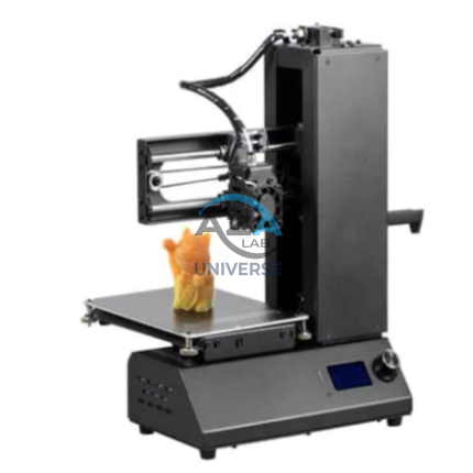
3D PRINTER AZA1255
The AZA1255 AZALAB 3D Printer is a high-precision, versatile additive manufacturing system engineered for educational institutions, research laboratories, professional design studios, and industrial prototyping environments. Designed to deliver speed, accuracy, and repeatability, this advanced 3D printer is ideal for producing functional prototypes, detailed models, custom components, architectural parts, and educational aids.
Combining robust mechanical design with intelligent control software, the AZA1255 ensures consistent, high-quality output across a wide range of applications.
ABRASION TESTING MACHINE FOR GLAZED TILES AZA1262
The AZA LAB Abrasion Testing Machine for Glazed Tiles (AZA1262) is a robust, high-performance laboratory instrument engineered for precise and high-speed abrasion resistance testing of glazed ceramic tiles. Fully compliant with BIS 13630-11 and EN ISO 10545-7, this machine is designed to ensure reliable evaluation of tile durability under simulated real-world wear conditions.
With the capability to test up to four specimens simultaneously, the AZA1262 significantly improves testing efficiency while maintaining exceptional accuracy and repeatability—making it ideal for tile manufacturers, certification laboratories, and quality control departments
PETROLEUM PRODUCT DISTILLATION TESTER AZA1284
The AZA1284 Manual Distillation Unit from AZA Lab is a high-precision, front-type petroleum distillation system engineered for accurate determination of distillation characteristics of petroleum products in accordance with ASTM D86 and GB/T 6536 test methods. Designed for laboratories that require reliable manual control with superior thermal stability, this unit delivers consistent, repeatable, and standards-compliant results.
With its dual-unit configuration, independently controlled constant-temperature baths, and continuously adjustable heating power, the AZA1284 offers exceptional flexibility and efficiency for routine quality control, inspection, and research applications.
Related products
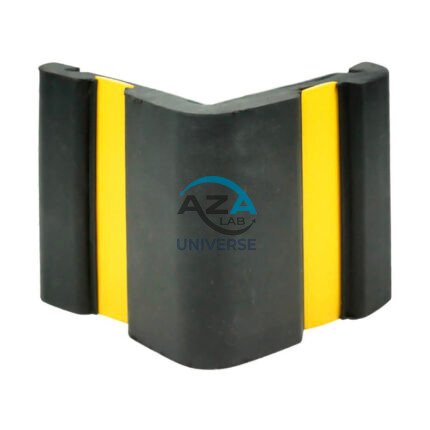
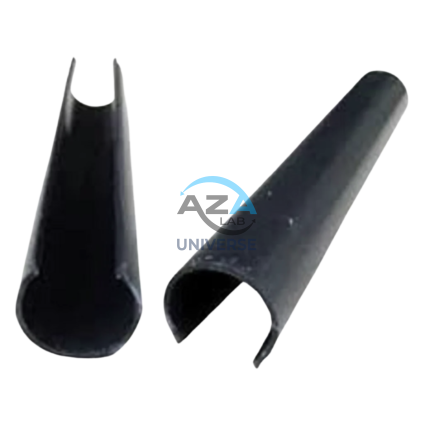
CORNER GUARD AZA1022
Wall & Edge Protection Solutions for Safety, Durability, and Aesthetics by Azalab
The AZA1022 Corner Guards are a practical, durable, and cost-effective solution for protecting wall edges and exposed corners from impact damage in both residential and commercial environments. Designed to prevent chipping, cracking, abrasion, and collision damage, these guards are especially essential in high-traffic areas where trolleys, carts, wheelchairs, forklifts, or vehicles are frequently in use.
Azalab’s AZA1022 range combines impact resistance, safety visibility, and clean aesthetics, ensuring long-term protection while maintaining the visual integrity of interior and exterior spaces.
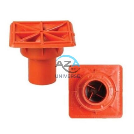
IMPALEMENT SAFETY COVERS AZA1023
Rebar Protection Solutions for Construction Site Safety & Compliance by Azalab
AZA1023 Impalement Safety Covers are critical safety components designed to protect workers, visitors, and pedestrians from impalement hazards caused by exposed reinforcement bars (rebars) on construction sites. These covers significantly reduce the risk of serious injury or fatal accidents while helping projects comply with mandatory safety regulations such as OSHA, BIS, and international construction safety standards.
At Azalab, safety is engineered into every detail. The AZA1023 range is developed to deliver high impact resistance, excellent visibility, easy installation, and long service life, making it an essential safety accessory for residential, commercial, and large-scale infrastructure projects

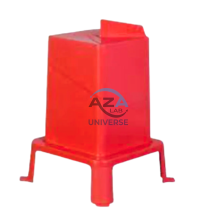
ROUND POST HOLE FORM AZA1020
Precision Cylindrical Concrete Formwork for Posts & Foundations by Azalab
The AZA1020 Round Post Hole Form is a high-performance cylindrical mold engineered for forming strong, uniform concrete footings for posts, poles, fences, and light structural foundations. Designed for both professional contractors and serious DIY users, this form ensures accuracy, speed, and consistency in concrete placement while minimizing material waste.
Ideal for fencing, decking, lighting poles, signposts, and temporary or permanent structures, the AZA1020 delivers clean finishes and dependable load-bearing performance.
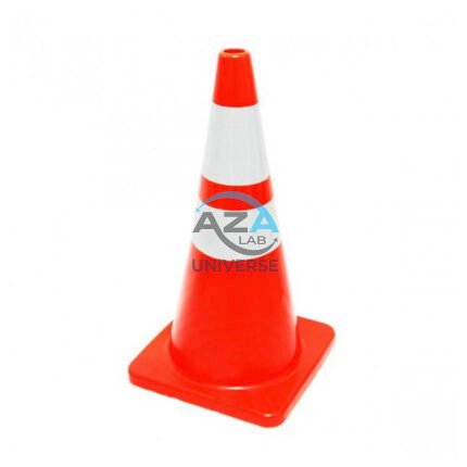
SAFETY CONE AZA1026
High-Visibility Traffic & Site Safety Cone by Azalab
The AZA1026 Safety Cone is a versatile and essential safety device used for traffic control, hazard marking, and area demarcation across construction sites, roads, laboratories, parking areas, and industrial facilities. Designed for maximum visibility, durability, and ease of handling, AZA1026 provides reliable performance in both indoor and outdoor environments.
SCAFFOLD POLY CLIP AZA1019
Secure Fastening Solution for Debris Netting & Protective Mesh by Azalab
AZA1019 Scaffold Poly Clips are essential construction safety accessories designed for the secure fastening of debris netting, shade mesh, and protective sheeting to scaffolding structures. Engineered for durability, safety, and ease of use, these clips provide a tool-free, reusable, and weather-resistant fixing solution for construction and industrial sites.
Widely used by builders, safety officers, scaffolding contractors, and site supervisors, AZA1019 clips help improve site safety, dust control, and environmental protection at height.
SQUARE HOLE FORM AZA1021
Precision Square Concrete Footing Mold for Posts & Structural Bases by Azalab
The AZA1021 Square Hole Form is a rigid, pre-engineered concrete mold designed for forming accurate square foundations for posts, pillars, fencing systems, signage, decks, and structural columns. Engineered for speed, precision, and consistency, this form is ideal for residential, commercial, and infrastructure projects where square geometry and sharp edges are structurally or aesthetically required.
Available from Azalab, the AZA1021 enables contractors, landscapers, and builders to pour concrete footings cleanly and efficiently while reducing labor time and material waste.
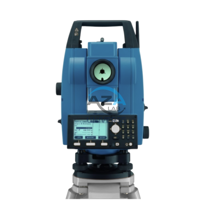
TOTAL STATION BUILDER AZA1029
AZA1029 Total Station Builder
The AZA1029 Total Station Builder is a high-precision digital surveying instrument engineered for construction layout, topographic surveying, and leveling applications. Combining an electronic theodolite, advanced EDM technology, and integrated survey software into a single rugged platform, AZA1029 delivers accuracy, efficiency, and reliability for demanding field environments.
Designed specifically for civil engineers, surveyors, and construction professionals, the AZA1029 ensures fast, repeatable, and highly accurate positioning across complex job sites.

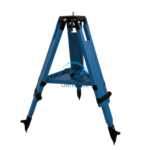
WOODEN TRIPOD AZA1038
Superior Stability with Natural Vibration Dampening
Unlike aluminum tripods, wooden tripods provide natural vibration absorption, making them the preferred choice for total stations, theodolites, laser scanners, and auto levels—especially for long-distance and high-accuracy measurements. The AZA1038 is manufactured from seasoned hardwood, carefully selected and treated to resist moisture, warping, and deformation, ensuring consistent performance in both dry and humid environments