
 Rock
Rock Aggregate
 Cement
 Concrete
 Soil
Soil Steel
Steel Bitumen/Asphalt
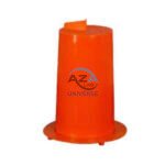 Security Survey Equipment
 General Items
")
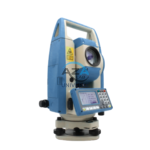
TOTAL STATION BUILDER AZA1029
AZA1029 Total Station Builder
The AZA1029 Total Station Builder is a high-precision digital surveying instrument engineered for construction layout, topographic surveying, and leveling applications. Combining an electronic theodolite, advanced EDM technology, and integrated survey software into a single rugged platform, AZA1029 delivers accuracy, efficiency, and reliability for demanding field environments.
Designed specifically for civil engineers, surveyors, and construction professionals, the AZA1029 ensures fast, repeatable, and highly accurate positioning across complex job sites.
Description
High-Accuracy Measurement for Construction & Surveying
The AZA1029 is equipped with a powerful EDM system capable of long-range prism measurement up to 5,000 meters and reflectorless measurement up to 500 meters, making it ideal for both accessible and hazardous locations.
High-resolution angular encoders provide 2″ or 5″ angular accuracy (model dependent), ensuring precise horizontal and vertical angle measurements for critical layout and alignment tasks.
Typical applications include:
-
Control point establishment
-
Building foundation layout
-
Grid and column setting
-
Road, bridge, and infrastructure alignment
Advanced EDM & Optical Performance
-
Prism and reflectorless measurement modes
-
Fast distance acquisition with millimeter accuracy
-
Dual-axis compensator for automatic tilt correction
-
High-quality telescope optics for clear long-range sighting
These features minimize setup errors and improve reliability even on uneven or challenging terrain.
User-Friendly Digital Interface
The AZA1029 features a dual-sided, backlit LCD display paired with an intuitive alphanumeric keypad, allowing easy operation from either face of the instrument.
Interface benefits include:
-
Instant display of angle and distance readings
-
Simple menu-driven navigation
-
Direct coordinate input and offset calculations
-
On-screen stakeout guidance
This design ensures ease of use for both experienced professionals and new operators.
Integrated Survey Software Functions
The total station is preloaded with essential survey and construction software tools, including:
-
Point-to-point measurement
-
Coordinate Geometry (COGO)
-
Area and volume calculation
-
Missing line measurement
-
Resection and traversing
-
Stakeout and alignment routines
These functions significantly streamline construction layout and topographic workflows.
Data Storage & Connectivity
The AZA1029 supports efficient data management and transfer through:
-
Internal memory for 20,000+ survey points
-
USB and SD card support
-
Bluetooth connectivity for wireless data transfer
Collected data can be exported seamlessly to CAD, GIS, and BIM platforms for further processing and reporting.
Rugged & Field-Ready Construction
Built for harsh site conditions, the AZA1029 features a shock-resistant chassis and IP65-rated protection, safeguarding internal optics and electronics from dust, rain, and humidity.
Additional durability features:
-
Sealed optical and electronic components
-
Ergonomic carry handle
-
Long-life rechargeable battery with up to 16 hours of continuous operation
The instrument mounts on a standard 5/8-inch tripod thread and supports optical or laser plummet systems for precise centering.
Applications
The AZA1029 Total Station Builder is ideal for:
-
Construction layout and leveling
-
Topographic mapping
-
Road, bridge, and railway projects
-
Land parcel demarcation
-
Utility grid staking
-
Architectural and structural alignment
-
Engineering and surveying training institutes
Technical Specifications – AZA1029
| Feature | Specification |
|---|---|
| Measuring Range (Prism) | Up to 5,000 m |
| Reflectorless Range | Up to 500 m |
| Angle Accuracy | 2″ or 5″ (model dependent) |
| Distance Accuracy | ±(2 mm + 2 ppm) |
| Display | Dual LCD, backlit with keypad |
| Data Storage | 20,000+ points |
| Connectivity | USB, SD card, Bluetooth |
| Battery Life | Up to 16 hours |
| Weight | 5.5 – 6.5 kg (with battery) |
| Software Functions | Stakeout, COGO, Resection, Area Calculation |
| Environmental Protection | IP65 dust & water resistant |
Key Advantages of AZA1029
-
High-accuracy electronic total station for construction and surveying
-
Long-range EDM up to 5,000 m with prism
-
Reflectorless capability for inaccessible targets
-
Dual-axis compensator for reliable angle correction
-
Built-in data storage with USB and Bluetooth transfer
-
Easy-to-read LCD with alphanumeric keypad
-
Rugged, weatherproof design for field use
Frequently Asked Questions (FAQ)
Q1: What is the AZA1029 mainly used for?
A: Construction layout, leveling, alignment, and precise point positioning.
Q2: Can it work without a prism?
A: Yes, it supports reflectorless measurements up to 500 m.
Q3: How can data be transferred?
A: Via USB, SD card, or Bluetooth to CAD/GIS software.
Q4: Is it suitable for outdoor use?
A: Yes, the IP65-rated design ensures reliable operation in harsh environments.
Q5: Is it beginner-friendly?
A: Yes, the intuitive interface and guided software functions make it easy to operate.
Additional information
| Measuring Range (Prism) |
Up to 5,000 m |
|---|---|
| Reflectorless Range |
Up to 500 m |
| Angle Accuracy |
2" or 5" (depends on model) |
| Distance Accuracy |
±(2 mm + 2 ppm) |
You may also like…
DIGITAL BLAINE AIR PERMEABILITY APPARATUS AZA0798
- Digital model for precise fineness testing
- Measures surface area in cm²/g (1500–6000 range)
- Complies with IS 4031 Part 2 and ASTM C204
- Built-in vacuum pump with digital timer
- Ideal for cement QC, R&D, and educational labs
- Includes calibration certificate & accessories
VOLUME CHANGE APPARATUS AZA0796
- Precision apparatus for measuring soil volume change
- Ideal for CD and CU triaxial testing
- Manual and digital versions available
- Durable lab-grade stainless steel build
- Fully compliant with IS and ASTM standards
- Provided with all necessary accessories
- Backed by Azalab’s quality assurance and support
Related products
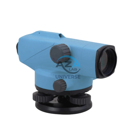
AUTOMATIC LEVEL AZA1031
AZA1031 Automatic Level (Auto Level / Optical Level)
The AZA1031 Automatic Level is a precision optical leveling instrument engineered for accurate elevation measurement in surveying, construction layout, and civil engineering projects. Designed for durability and long-term accuracy, it delivers consistent performance in demanding outdoor environments while remaining simple and efficient to operate.
Reliable Self-Leveling Performance
At the core of the AZA1031 is a magnetic damping compensator that automatically corrects minor tilts and vibrations. This self-leveling mechanism ensures a stable horizontal line of sight without continuous manual adjustment, significantly reducing setup time and operator error.
Once roughly leveled using the circular bubble vial, the internal compensator completes the leveling process automatically, making the instrument ideal for long-distance and repetitive leveling tasks.
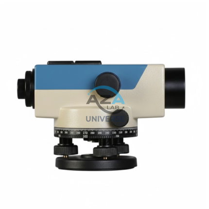
AUTOMATIC LEVEL AZA1033
AZA1033 Automatic Level (Auto Level / Self-Leveling Optical Level)
The AZA1033 Automatic Level is a high-precision optical surveying instrument engineered for accurate elevation measurement in construction, roadwork, and civil engineering projects. Designed to establish and verify horizontal planes over long distances, it is an essential tool for engineers, surveyors, and site supervisors who require speed, stability, and dependable accuracy.
Self-Leveling Accuracy with Built-in Compensator
Unlike manual leveling instruments, the AZA1033 features a self-leveling compensator system that automatically maintains a true horizontal line of sight. Once roughly leveled using the circular bubble vial, the internal compensator corrects minor tilts and vibrations instantly.
This mechanism significantly reduces setup time, eliminates operator error, and ensures stable readings even on uneven ground or vibration-prone sites
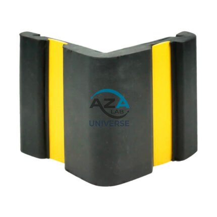
CORNER GUARD AZA1022
Wall & Edge Protection Solutions for Safety, Durability, and Aesthetics by Azalab
The AZA1022 Corner Guards are a practical, durable, and cost-effective solution for protecting wall edges and exposed corners from impact damage in both residential and commercial environments. Designed to prevent chipping, cracking, abrasion, and collision damage, these guards are especially essential in high-traffic areas where trolleys, carts, wheelchairs, forklifts, or vehicles are frequently in use.
Azalab’s AZA1022 range combines impact resistance, safety visibility, and clean aesthetics, ensuring long-term protection while maintaining the visual integrity of interior and exterior spaces.
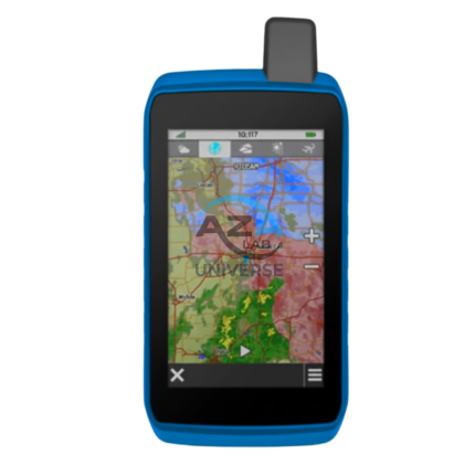
GPS SYSTEM AZA1039
AZA1039 GPS System (Professional GNSS Surveying Receiver)
The AZA1039 GPS System from Azalab is a high-performance, field-grade GNSS positioning solution engineered for land surveying, GIS mapping, construction layout, and geospatial data collection. Designed to deliver reliable accuracy in challenging environments, this system combines multi-constellation satellite tracking, real-time corrections, and rugged field durability.
Advanced Multi-Constellation GNSS Accuracy
Modern surveying demands precision beyond consumer-grade navigation devices. The AZA1039 utilizes multi-band GNSS technology, tracking multiple satellite constellations simultaneously, including:
-
GPS
-
GLONASS
-
Galileo
-
BeiDou
This ensures faster signal acquisition, higher positional reliability, and improved performance under tree canopy, near buildings, and in difficult terrain. When paired with RTK (Real-Time Kinematic) corrections, the system delivers centimeter-level accuracy, making it suitable for high-precision professional work.

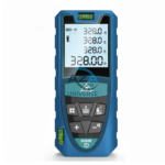
LASER DISTANCE METER AZA1030
AZA1030 Laser Distance Meter
The AZA1030 Laser Distance Meter is a compact, high-precision digital measuring instrument designed for fast, accurate, and efficient distance measurement across construction, interior design, surveying, and real estate applications. Replacing conventional tape measures, the AZA1030 delivers instant results at the push of a button while significantly reducing manual errors and site time.
Fast & Accurate Digital Measurement
Powered by advanced laser diode technology, the AZA1030 provides measurement accuracy up to ±1.5 mm, with model-dependent measuring ranges extending up to 100 meters. It supports multiple measuring functions, enabling professionals to capture complex dimensions quickly and reliably.
Measurement capabilities include:
-
Single and continuous distance measurement
-
Area and volume calculation
-
Indirect height and distance measurement (Pythagorean mode)
-
Minimum / maximum tracking
This makes AZA1030 ideal for layout planning, verification, and space assessment.
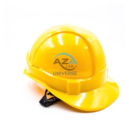
SAFETY HELMET AZA1025
Industrial & Laboratory Head Protection Helmet by Azalab
The AZA1025 Safety Helmet is a critical component of personal protective equipment (PPE), engineered to deliver reliable head protection, long-wearing comfort, and certified safety compliance across construction, industrial, laboratory, and infrastructure environments.
Designed using advanced materials and ergonomic principles, AZA1025 ensures maximum protection against falling objects, accidental impacts, and workplace hazards while remaining lightweight and comfortable for extended use.
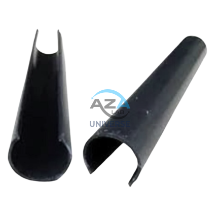
SCAFFOLD POLY CLIP AZA1019
Secure Fastening Solution for Debris Netting & Protective Mesh by Azalab
AZA1019 Scaffold Poly Clips are essential construction safety accessories designed for the secure fastening of debris netting, shade mesh, and protective sheeting to scaffolding structures. Engineered for durability, safety, and ease of use, these clips provide a tool-free, reusable, and weather-resistant fixing solution for construction and industrial sites.
Widely used by builders, safety officers, scaffolding contractors, and site supervisors, AZA1019 clips help improve site safety, dust control, and environmental protection at height.
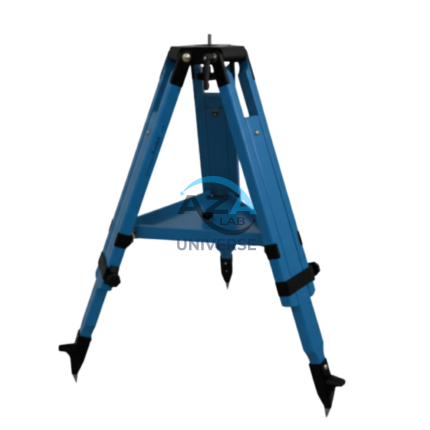
WOODEN TRIPOD AZA1038
Superior Stability with Natural Vibration Dampening
Unlike aluminum tripods, wooden tripods provide natural vibration absorption, making them the preferred choice for total stations, theodolites, laser scanners, and auto levels—especially for long-distance and high-accuracy measurements. The AZA1038 is manufactured from seasoned hardwood, carefully selected and treated to resist moisture, warping, and deformation, ensuring consistent performance in both dry and humid environments