
 Rock
Rock Aggregate
 Cement
 Concrete
 Soil
Soil Steel
Steel Bitumen/Asphalt
 Security Survey Equipment
 General Items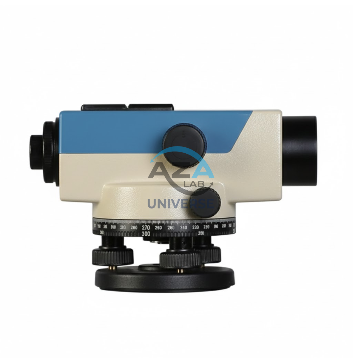
AUTOMATIC LEVEL AZA1033
AZA1033 Automatic Level (Auto Level / Self-Leveling Optical Level)
The AZA1033 Automatic Level is a high-precision optical surveying instrument engineered for accurate elevation measurement in construction, roadwork, and civil engineering projects. Designed to establish and verify horizontal planes over long distances, it is an essential tool for engineers, surveyors, and site supervisors who require speed, stability, and dependable accuracy.
Self-Leveling Accuracy with Built-in Compensator
Unlike manual leveling instruments, the AZA1033 features a self-leveling compensator system that automatically maintains a true horizontal line of sight. Once roughly leveled using the circular bubble vial, the internal compensator corrects minor tilts and vibrations instantly.
This mechanism significantly reduces setup time, eliminates operator error, and ensures stable readings even on uneven ground or vibration-prone sites
Description
High-Quality Optics for Clear Long-Distance Viewing
The AZA1033 is equipped with a precision telescope offering 20x to 32x magnification, depending on the model. Its multi-coated optical lenses enhance light transmission, delivering sharp, bright images even in low-light conditions.
With a reading accuracy of ±1.5 mm to ±2.5 mm per kilometer (double-run leveling), the instrument is suitable for high-accuracy applications such as road gradients, foundation leveling, and drainage planning.
Magnetic / Air-Damped Compensator System
The integrated magnetic or air-damped compensator stabilizes the line of sight quickly after minor disturbances. This ensures consistent measurements during continuous operation, making the AZA1033 ideal for long workdays on active construction sites.
360° Horizontal Measurement & Smooth Operation
The instrument features a 360-degree horizontal graduated circle, allowing basic angular measurements for alignment and layout tasks. Smooth horizontal motion and fine-tuning knobs enable precise aiming, while the minimum focus distance of 0.5–1.0 meters supports both close-range and long-distance measurements.
Rugged, Weather-Resistant Construction
Built for field durability, the AZA1033 comes with a weather-resistant housing that protects internal optics and mechanisms from dust, moisture, and minor impacts. Its robust design ensures reliable performance in demanding outdoor environments, from urban construction sites to remote infrastructure projects.
The unit mounts securely on any standard 5/8-inch tripod and is compatible with metric and imperial leveling staffs.
Typical Applications
The AZA1033 Automatic Level is widely used for:
-
Building foundation and floor leveling
-
Road and railway alignment
-
Drainage and pipeline gradient planning
-
Earthwork cut-and-fill calculations
-
Land surveying and elevation profiling
-
Site inspections and benchmark transfer
It is suitable for both professional field use and academic training in civil engineering and surveying.
Technical Specifications – AZA1033
| Feature | Specification |
|---|---|
| Telescope Magnification | 20x to 32x (model-dependent) |
| Objective Aperture | Approx. 36 mm |
| Field of View | ≥ 1° 30′ |
| Minimum Focus Distance | 0.5 – 1.0 m |
| Compensator Type | Magnetic or air-dampened |
| Accuracy (Double Run) | ±1.5 mm to ±2.5 mm per km |
| Horizontal Circle | 360° graduated |
| Tripod Mount | Standard 5/8 inch |
| Weight | Approx. 1.5 – 2.5 kg |
Key Advantages of AZA1033
-
Precision automatic leveling for construction and surveying
-
Built-in compensator for fast, stable horizontal alignment
-
Clear optics with 20x–32x magnification options
-
Smooth 360° horizontal rotation with fine adjustment
-
Durable, weather-resistant design for field conditions
-
No power or batteries required
-
Compatible with standard tripods and leveling staffs
Frequently Asked Questions (FAQ)
Q1: What is the difference between an automatic level and a dumpy level?
An automatic level uses a built-in compensator for self-leveling, while a dumpy level requires repeated manual adjustment.
Q2: Is AZA1033 suitable for road construction projects?
Yes. It is commonly used for road alignment, slope verification, and elevation control.
Q3: Does the instrument require batteries?
No. The AZA1033 is a purely optical instrument and does not require any power source.
Q4: Can I use any tripod with this level?
Yes, as long as the tripod has a standard 5/8-inch mounting thread.
Q5: How often should calibration be performed?
Periodic calibration is recommended, especially if the instrument is transported frequently or used on rugged sites.
Additional information
| Telescope Magnification |
20x to 32x (depending on model) |
|---|---|
| Objective Aperture |
Approx. 36mm |
| Field of View |
1° 30' or wider |
| Minimum Focus Distance |
0.5 to 1 meter |
Related products
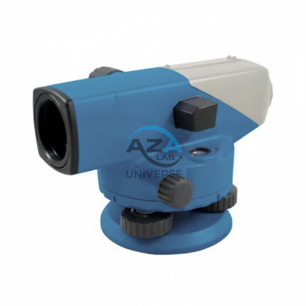
AUTOMATIC LEVEL AZA1032
AZA1032 Automatic Level (Self-Leveling Optical Level)
The AZA1032 Automatic Level is a precision self-leveling optical instrument designed for accurate height transfer, alignment, and leveling operations in construction, surveying, and civil engineering projects. Engineered for reliability, ease of use, and field durability, it delivers consistent performance on demanding job sites.
Automatic Self-Leveling Accuracy
At the core of the AZA1032 is a built-in compensator mechanism that automatically aligns the line of sight to a true horizontal plane. After rough leveling using the circular bubble vial, the compensator fine-tunes alignment instantly, eliminating manual errors and significantly reducing setup time.
This self-leveling system ensures stable readings even in environments affected by vibration or minor ground movement.
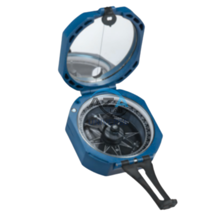
BRUNTON COMPASS AZA1042
The Brunton Compass AZA1042 from Azalab is a professional-grade field instrument engineered for high-precision geological mapping, structural analysis, environmental surveying, and navigation. Recognized globally as the industry benchmark, this compass is trusted by geologists, civil engineers, surveyors, archaeologists, researchers, and students working in demanding outdoor environments.
Unlike conventional handheld compasses, the Brunton Compass is a multi-functional surveying tool, integrating a magnetic compass, clinometer, protractor, and mirror sighting system into a single compact instrument. This versatility allows accurate measurement of azimuth, strike, dip, inclination, and slope angles, making it indispensable for scientific fieldwork.
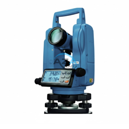
ELECTRONIC THEODOLITE AZA1027
Precision Redefined for Field Surveying
The AZA1027 is an essential instrument for topographic surveys, construction layout, and structural alignment. Equipped with high-resolution angle encoders, it significantly reduces reading errors and ensures consistent measurement accuracy.
An integrated optical plummet and dual-axis compensator allow reliable operation even on uneven terrain. With angular accuracy ranging from ±2″ to ±5″ seconds (model dependent), the AZA1027 is ideal for projects requiring tight tolerances such as bridges, tunnels, and high-rise structures.
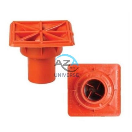
IMPALEMENT SAFETY COVERS AZA1023
Rebar Protection Solutions for Construction Site Safety & Compliance by Azalab
AZA1023 Impalement Safety Covers are critical safety components designed to protect workers, visitors, and pedestrians from impalement hazards caused by exposed reinforcement bars (rebars) on construction sites. These covers significantly reduce the risk of serious injury or fatal accidents while helping projects comply with mandatory safety regulations such as OSHA, BIS, and international construction safety standards.
At Azalab, safety is engineered into every detail. The AZA1023 range is developed to deliver high impact resistance, excellent visibility, easy installation, and long service life, making it an essential safety accessory for residential, commercial, and large-scale infrastructure projects
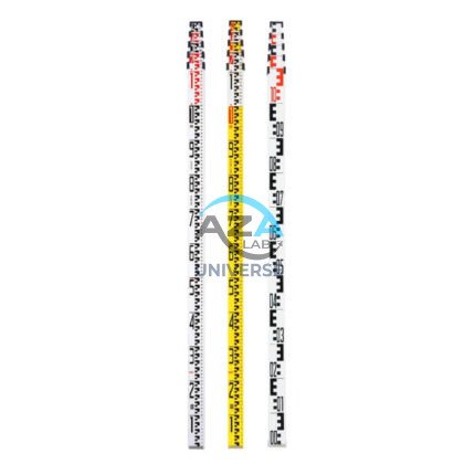
LEVELLING STAVES AZA1034
AZA1034 Levelling Staves (Survey Staff / Leveling Staff)
The AZA1034 Levelling Staff is an essential surveying accessory used in conjunction with dumpy levels, automatic levels, and digital levels to accurately measure height differences between ground points. Designed for reliability, visibility, and ease of handling, it is a critical tool for construction, civil engineering, and land surveying applications.
Accurate Elevation Measurement
Levelling staves provide a vertical reference that allows surveyors and engineers to determine elevation differences with precision. When viewed through an optical leveling instrument, the graduated scale on the AZA1034 enables clear and accurate readings, ensuring dependable height transfer across distances.
The staff is available with metric (cm/m) or imperial (ft/in) graduations, depending on project requirements.
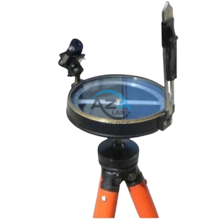
PRISMATIC COMPASS AZA1043
The Prismatic Compass AZA1043 from Azalab is a professional-grade navigation and surveying instrument designed for land surveying, geological exploration, mapping, and field navigation. Built for accuracy, durability, and ease of use, this compass is widely relied upon by surveyors, geologists, civil engineers, military personnel, students, and outdoor professionals operating in diverse and challenging environments.
Unlike conventional magnetic compasses, the prismatic compass incorporates an optical prism system that allows the user to simultaneously sight a distant object and read the bearing. This unique feature significantly improves measurement accuracy, particularly for long-distance bearings, triangulation, and route alignment tasks
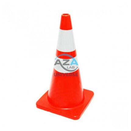
SAFETY CONE AZA1026
High-Visibility Traffic & Site Safety Cone by Azalab
The AZA1026 Safety Cone is a versatile and essential safety device used for traffic control, hazard marking, and area demarcation across construction sites, roads, laboratories, parking areas, and industrial facilities. Designed for maximum visibility, durability, and ease of handling, AZA1026 provides reliable performance in both indoor and outdoor environments.
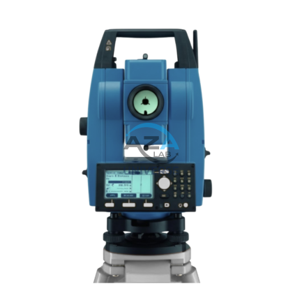
TOTAL STATION BUILDER AZA1029
AZA1029 Total Station Builder
The AZA1029 Total Station Builder is a high-precision digital surveying instrument engineered for construction layout, topographic surveying, and leveling applications. Combining an electronic theodolite, advanced EDM technology, and integrated survey software into a single rugged platform, AZA1029 delivers accuracy, efficiency, and reliability for demanding field environments.
Designed specifically for civil engineers, surveyors, and construction professionals, the AZA1029 ensures fast, repeatable, and highly accurate positioning across complex job sites.