
 Rock
Rock Aggregate
 Cement
 Concrete
 Soil
Soil Steel
Steel Bitumen/Asphalt
 Security Survey Equipment
 General Items
")

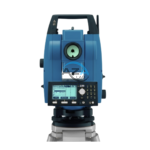
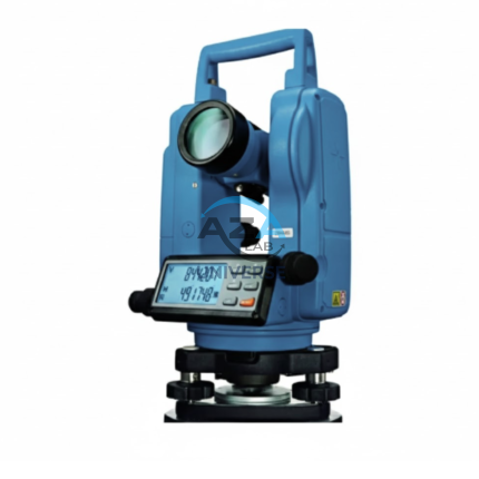
TOTAL STATION AZA1028
AZA1028 Total Station
The AZA1028 Total Station is a high-performance, all-in-one surveying instrument that integrates an electronic theodolite, electronic distance measurement (EDM), and advanced data recording into a single, robust platform. Designed for precision, efficiency, and durability, AZA1028 is an indispensable solution for civil engineers, construction professionals, land surveyors, and GIS specialists.
Description
High-Precision Distance & Angle Measurement
Equipped with a powerful built-in EDM system, the AZA1028 delivers millimeter-level distance accuracy and high-resolution angular measurement. It supports long-range prism measurements as well as fast reflectorless operation, allowing surveyors to work efficiently across varied site conditions.
Measurement capabilities include:
-
Horizontal and vertical angle measurement
-
Prism and reflectorless distance measurement
-
Instant 3D coordinate calculation (X, Y, Z)
-
Stake-out, remote elevation, and missing-line functions
These features significantly reduce field time and manual computation errors.
Advanced Measurement Modes
-
Single and continuous angle measurement
-
Reflectorless mode up to short-range targets
-
Prism-based long-distance measurement
-
Coordinate measurement and layout mode
Ideal for:
-
Site layout and topographic mapping
-
Road, tunnel, and railway alignment
-
Structural monitoring and utility mapping
User-Friendly Digital Interface
The AZA1028 features an intuitive operating system designed for fast learning and efficient field use.
Interface highlights:
-
Dual-face color touchscreen / LCD display
-
Alphanumeric keypad for quick data entry
-
Guided workflows for layout and survey tasks
-
Internal memory with SD card and USB support
-
Real-time Bluetooth / Wi-Fi connectivity (model dependent)
Survey data can be transferred seamlessly to CAD and GIS software such as AutoCAD and QGIS.
Data Logging & Connectivity
-
Internal memory for 10,000 to 50,000 points
-
SD card support for extended storage
-
USB, Bluetooth, and RS-232 data transfer
-
Supports common formats: CSV, DXF, TXT
This ensures smooth integration with government, infrastructure, and private-sector survey workflows.
Rugged Design for Field Conditions
The AZA1028 is engineered for reliability in challenging environments. Its weather-resistant housing and ergonomic design ensure consistent performance on construction sites, highways, and remote locations.
Key durability features:
-
IP55 / IP66 dust and water resistance
-
Long-life rechargeable Li-ion battery (8–16 hours)
-
Lightweight yet robust construction
Wide Range of Applications
The AZA1028 Total Station is suitable for:
-
Land and boundary surveys
-
Construction layout and alignment
-
Mining and geological exploration
-
Topographic and GIS data collection
-
Utility corridor and telecom planning
-
Educational and training laboratories
Technical Specifications – AZA1028
| Feature | Specification |
|---|---|
| Distance Accuracy (Prism) | ±(2 mm + 2 ppm) |
| Distance Accuracy (No Prism) | ±(3 mm + 2 ppm) |
| Angle Measurement Accuracy | 2″ to 5″ seconds |
| Telescope Magnification | 30× |
| Display | Dual-face touchscreen / LCD |
| Data Storage | 10,000 – 50,000 points |
| Connectivity | USB, SD card, Bluetooth, RS-232 |
| Battery Backup | 8–16 hours (Li-ion rechargeable) |
| Environmental Protection | IP55 / IP66 |
| Weight | 5–6 kg (with battery & tribrach) |
Key Advantages of AZA1028
-
Precise distance, angle, and coordinate measurement
-
Combines EDM and theodolite in one instrument
-
Touchscreen interface with onboard data storage
-
Bluetooth, USB, and SD card connectivity
-
Long battery life and rugged, weather-resistant build
-
Ideal for construction, GIS, and land surveying
Frequently Asked Questions (FAQ)
Q1: What does the AZA1028 measure?
A: Horizontal and vertical angles, slope distances, and calculated X, Y, Z coordinates.
Q2: Is a prism mandatory?
A: No. It supports both reflectorless and prism-based measurements.
Q3: Can data be exported to AutoCAD?
A: Yes. Data can be exported in CSV or DXF formats.
Q4: Can it operate in rain or low light?
A: Yes. With IP-rated protection and a backlit display, it performs reliably in adverse conditions.
Q5: Is AZA1028 suitable for educational institutions?
A: Yes. It is widely used in engineering colleges and surveying training labs.
Additional information
| Distance Accuracy (Prism) |
±(2mm + 2ppm) |
|---|---|
| Distance Accuracy (No Prism) |
±(3mm + 2ppm) |
| Angle Measurement Accuracy |
2" to 5" seconds |
| Telescope Magnification |
30x |
Related products
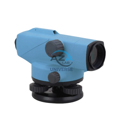
AUTOMATIC LEVEL AZA1031
AZA1031 Automatic Level (Auto Level / Optical Level)
The AZA1031 Automatic Level is a precision optical leveling instrument engineered for accurate elevation measurement in surveying, construction layout, and civil engineering projects. Designed for durability and long-term accuracy, it delivers consistent performance in demanding outdoor environments while remaining simple and efficient to operate.
Reliable Self-Leveling Performance
At the core of the AZA1031 is a magnetic damping compensator that automatically corrects minor tilts and vibrations. This self-leveling mechanism ensures a stable horizontal line of sight without continuous manual adjustment, significantly reducing setup time and operator error.
Once roughly leveled using the circular bubble vial, the internal compensator completes the leveling process automatically, making the instrument ideal for long-distance and repetitive leveling tasks.
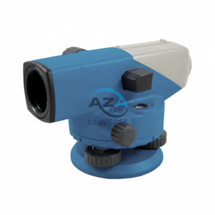
AUTOMATIC LEVEL AZA1032
AZA1032 Automatic Level (Self-Leveling Optical Level)
The AZA1032 Automatic Level is a precision self-leveling optical instrument designed for accurate height transfer, alignment, and leveling operations in construction, surveying, and civil engineering projects. Engineered for reliability, ease of use, and field durability, it delivers consistent performance on demanding job sites.
Automatic Self-Leveling Accuracy
At the core of the AZA1032 is a built-in compensator mechanism that automatically aligns the line of sight to a true horizontal plane. After rough leveling using the circular bubble vial, the compensator fine-tunes alignment instantly, eliminating manual errors and significantly reducing setup time.
This self-leveling system ensures stable readings even in environments affected by vibration or minor ground movement.
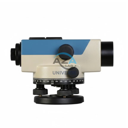
AUTOMATIC LEVEL AZA1033
AZA1033 Automatic Level (Auto Level / Self-Leveling Optical Level)
The AZA1033 Automatic Level is a high-precision optical surveying instrument engineered for accurate elevation measurement in construction, roadwork, and civil engineering projects. Designed to establish and verify horizontal planes over long distances, it is an essential tool for engineers, surveyors, and site supervisors who require speed, stability, and dependable accuracy.
Self-Leveling Accuracy with Built-in Compensator
Unlike manual leveling instruments, the AZA1033 features a self-leveling compensator system that automatically maintains a true horizontal line of sight. Once roughly leveled using the circular bubble vial, the internal compensator corrects minor tilts and vibrations instantly.
This mechanism significantly reduces setup time, eliminates operator error, and ensures stable readings even on uneven ground or vibration-prone sites
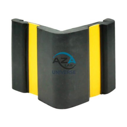
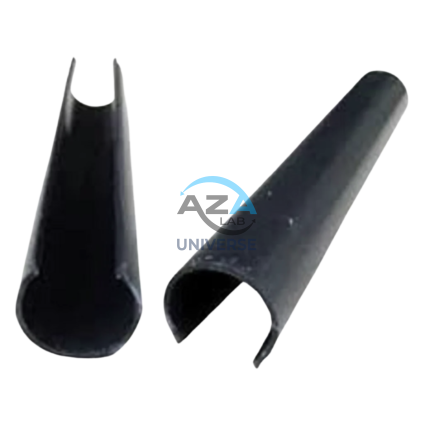
CORNER GUARD AZA1022
Wall & Edge Protection Solutions for Safety, Durability, and Aesthetics by Azalab
The AZA1022 Corner Guards are a practical, durable, and cost-effective solution for protecting wall edges and exposed corners from impact damage in both residential and commercial environments. Designed to prevent chipping, cracking, abrasion, and collision damage, these guards are especially essential in high-traffic areas where trolleys, carts, wheelchairs, forklifts, or vehicles are frequently in use.
Azalab’s AZA1022 range combines impact resistance, safety visibility, and clean aesthetics, ensuring long-term protection while maintaining the visual integrity of interior and exterior spaces.
ELECTRONIC THEODOLITE AZA1027
Precision Redefined for Field Surveying
The AZA1027 is an essential instrument for topographic surveys, construction layout, and structural alignment. Equipped with high-resolution angle encoders, it significantly reduces reading errors and ensures consistent measurement accuracy.
An integrated optical plummet and dual-axis compensator allow reliable operation even on uneven terrain. With angular accuracy ranging from ±2″ to ±5″ seconds (model dependent), the AZA1027 is ideal for projects requiring tight tolerances such as bridges, tunnels, and high-rise structures.
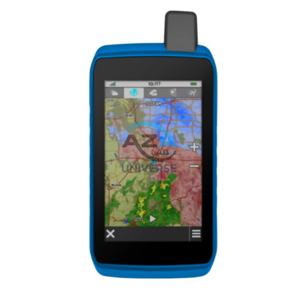
GPS SYSTEM AZA1039
AZA1039 GPS System (Professional GNSS Surveying Receiver)
The AZA1039 GPS System from Azalab is a high-performance, field-grade GNSS positioning solution engineered for land surveying, GIS mapping, construction layout, and geospatial data collection. Designed to deliver reliable accuracy in challenging environments, this system combines multi-constellation satellite tracking, real-time corrections, and rugged field durability.
Advanced Multi-Constellation GNSS Accuracy
Modern surveying demands precision beyond consumer-grade navigation devices. The AZA1039 utilizes multi-band GNSS technology, tracking multiple satellite constellations simultaneously, including:
-
GPS
-
GLONASS
-
Galileo
-
BeiDou
This ensures faster signal acquisition, higher positional reliability, and improved performance under tree canopy, near buildings, and in difficult terrain. When paired with RTK (Real-Time Kinematic) corrections, the system delivers centimeter-level accuracy, making it suitable for high-precision professional work.
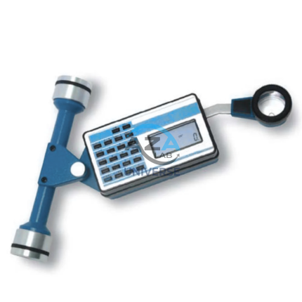
PLANIMETER AZA1040
SCAFFOLD POLY CLIP AZA1019
Secure Fastening Solution for Debris Netting & Protective Mesh by Azalab
AZA1019 Scaffold Poly Clips are essential construction safety accessories designed for the secure fastening of debris netting, shade mesh, and protective sheeting to scaffolding structures. Engineered for durability, safety, and ease of use, these clips provide a tool-free, reusable, and weather-resistant fixing solution for construction and industrial sites.
Widely used by builders, safety officers, scaffolding contractors, and site supervisors, AZA1019 clips help improve site safety, dust control, and environmental protection at height.