
 Rock
Rock Aggregate
 Cement
 Concrete
 Soil
Soil Steel
Steel Bitumen/Asphalt
 Security Survey Equipment
 General Items
")
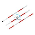
PRISM WITH POLE AZA1036
The AZA1036 Prism with Pole is a professional-grade surveying accessory designed for precise distance and angular measurements when used with total stations. This complete reflector-based surveying solution includes a high-accuracy prism, durable holder with target plate, and an adjustable telescopic pole—ensuring consistent performance across construction, cadastral, and topographic applications.
High-Precision Reflector for EDM Measurements
At the core of the AZA1036 is a single retroreflective survey prism, manufactured from high-purity optical glass and silver-coated for maximum signal return. The prism efficiently reflects the EDM signal back to the total station, enabling accurate distance measurement over long ranges—up to 2,000 meters, depending on instrument capability and site conditions.
The prism is housed in a rugged protective casing and mounted on a high-visibility target plate, allowing easy acquisition through the telescope even in low-light, foggy, or dusty environments.
Description
Standard Offset & Universal Compatibility
The AZA1036 prism supports standard offset values (-30 mm or 0 mm), making it fully compatible with leading total station brands including Leica, Topcon, Sokkia, Trimble, and Pentax. An integrated azimuth alignment ring ensures correct prism orientation regardless of the observation angle, reducing measurement errors during stakeout and control point surveys.
Adjustable Telescopic Prism Pole
The included telescopic prism pole is constructed from lightweight yet durable aluminum or fiberglass, offering excellent rigidity and portability. The pole extends from 1.5 m up to 5 m, with clearly marked metric or imperial graduations to allow precise height setting—critical for stakeout, elevation transfer, and offset measurements.
Secure twist-lock or flip-clamp mechanisms prevent height slippage during operation, ensuring measurement consistency.
Vertical Accuracy & Field Stability
To maintain perfect vertical alignment, the pole is equipped with an integrated circular bubble level, allowing the operator to keep the prism plumb during observations. This significantly minimizes vertical error, especially during long-range shots and high-accuracy control surveys.
The hardened base and robust pole construction provide stability on soil, asphalt, and compacted surfaces.
Rugged & Field-Ready Design
Designed for demanding site conditions, the AZA1036 prism assembly is sealed against dust and moisture, ensuring long service life and reliable performance in outdoor environments. The complete set is lightweight, easy to transport, and supplied with a protective carrying case for safe storage and mobility.
The modular design allows the prism to be easily removed or repositioned on the pole, offering flexibility for backsight, foresight, boundary marking, and elevation verification tasks.
Typical Applications
The AZA1036 Prism with Pole is ideal for:
-
Site layout and stakeout surveys
-
Control point and benchmark measurement
-
Boundary demarcation and cadastral surveys
-
Angle and distance triangulation
-
Road, rail, and infrastructure projects
-
Topographic and as-built surveys
Technical Specifications – AZA1036
| Feature | Specification |
|---|---|
| Prism Type | Single retroreflective, silver-coated |
| Prism Offset | -30 mm / 0 mm (selectable) |
| Reflective Range | Up to 2,000 m |
| Pole Material | Aluminum / Fiberglass |
| Pole Height Range | 1.5 m – 5 m (telescopic) |
| Pole Graduation | Metric / Imperial |
| Target Plate | Included, high-visibility |
| Bubble Level | Integrated circular level |
| Lock Type | Twist-lock / Flip clamp |
| Compatibility | Leica, Topcon, Sokkia, Trimble, Pentax |
| Carrying Case | Included (soft or hard shell) |
Key Features & Benefits
-
Complete prism and pole assembly for total station use
-
High-accuracy silver-coated survey prism
-
Long-range EDM capability up to 2,000 m
-
Telescopic pole with precise height graduations
-
Integrated bubble level for vertical alignment
-
Adjustable prism offset for universal compatibility
-
Durable, weather-resistant construction
-
Ideal for stakeout, layout, and control surveys
Frequently Asked Questions (FAQ)
Q1: What is the primary function of a survey prism?
It reflects the EDM signal from a total station, enabling accurate distance and angle measurement.
Q2: Is the AZA1036 compatible with all total stations?
Yes. It supports standard prism offsets and works with most major total station brands.
Q3: How tall does the prism pole extend?
The telescopic pole extends from 1.5 m to 5 m with clear graduations.
Q4: Does the set include a bubble level?
Yes. A built-in circular bubble level ensures proper vertical alignment.
Q5: Is it suitable for stakeout and boundary work?
Absolutely. It is designed specifically for stakeout, layout, and boundary demarcation tasks.
Additional information
| Prism Type |
Single retroreflective, silver-coated |
|---|---|
| Prism Offset |
-30 mm / 0 mm (selectable) |
| Reflective Range |
Up to 2,000 meters |
| Pole Material |
Aluminum / Fiberglass |
You may also like…
Related products
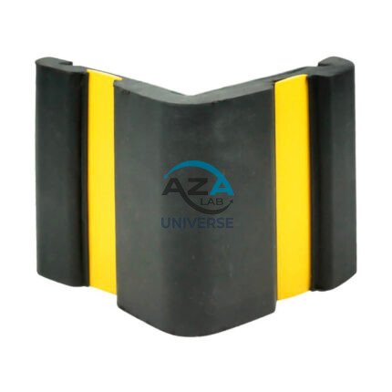
CORNER GUARD AZA1022
Wall & Edge Protection Solutions for Safety, Durability, and Aesthetics by Azalab
The AZA1022 Corner Guards are a practical, durable, and cost-effective solution for protecting wall edges and exposed corners from impact damage in both residential and commercial environments. Designed to prevent chipping, cracking, abrasion, and collision damage, these guards are especially essential in high-traffic areas where trolleys, carts, wheelchairs, forklifts, or vehicles are frequently in use.
Azalab’s AZA1022 range combines impact resistance, safety visibility, and clean aesthetics, ensuring long-term protection while maintaining the visual integrity of interior and exterior spaces.
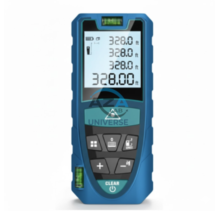
LASER DISTANCE METER AZA1030
AZA1030 Laser Distance Meter
The AZA1030 Laser Distance Meter is a compact, high-precision digital measuring instrument designed for fast, accurate, and efficient distance measurement across construction, interior design, surveying, and real estate applications. Replacing conventional tape measures, the AZA1030 delivers instant results at the push of a button while significantly reducing manual errors and site time.
Fast & Accurate Digital Measurement
Powered by advanced laser diode technology, the AZA1030 provides measurement accuracy up to ±1.5 mm, with model-dependent measuring ranges extending up to 100 meters. It supports multiple measuring functions, enabling professionals to capture complex dimensions quickly and reliably.
Measurement capabilities include:
-
Single and continuous distance measurement
-
Area and volume calculation
-
Indirect height and distance measurement (Pythagorean mode)
-
Minimum / maximum tracking
This makes AZA1030 ideal for layout planning, verification, and space assessment.
PLANE TABLE SET AZA1044
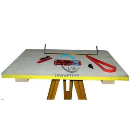
The Plane Table Set AZA1044 from Azalab is a classic and highly effective field surveying and mapping instrument used for topographic surveys, site layout, and civil engineering planning. Known for its simplicity, accuracy, and real-time plotting capability, this set is widely adopted by surveyors, civil engineers, geologists, architects, and engineering students for both professional and academic fieldwork.
Plane table surveying allows measurements and observations to be plotted directly onto paper at the survey site, eliminating transcription errors and significantly reducing post-field processing time. Unlike electronic instruments, this manual method provides a visual and intuitive understanding of terrain, making it especially valuable for education, reconnaissance surveys, and remote-area mapping.
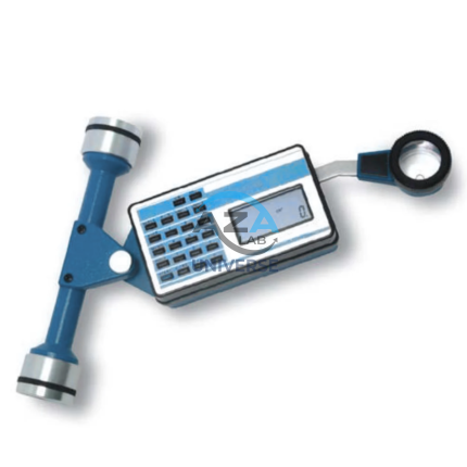
PLANIMETER AZA1040
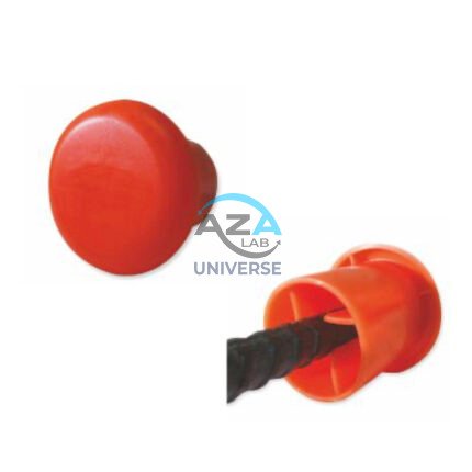
PROTECTIVE CAPS FOR REBAR, PIPE, BOLTS AZA1024
Multi-Purpose Safety Caps for Rebar, Pipes & Threaded Components by Azalab
AZA1024 Protective Caps are heavy-duty safety and maintenance accessories designed to protect workers, equipment, and materials on construction sites, industrial facilities, and fabrication yards. Engineered for injury prevention, corrosion protection, and regulatory compliance, these caps provide a simple yet highly effective solution for covering exposed rebars, pipe ends, bolts, and threaded rods.
Azalab’s AZA1024 range combines high visibility, impact resistance, and weather durability, making it suitable for demanding site conditions across residential, commercial, and infrastructure projects.
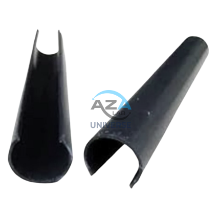
SCAFFOLD POLY CLIP AZA1019
Secure Fastening Solution for Debris Netting & Protective Mesh by Azalab
AZA1019 Scaffold Poly Clips are essential construction safety accessories designed for the secure fastening of debris netting, shade mesh, and protective sheeting to scaffolding structures. Engineered for durability, safety, and ease of use, these clips provide a tool-free, reusable, and weather-resistant fixing solution for construction and industrial sites.
Widely used by builders, safety officers, scaffolding contractors, and site supervisors, AZA1019 clips help improve site safety, dust control, and environmental protection at height.
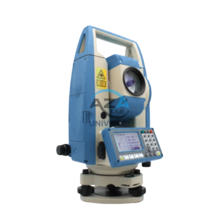
TOTAL STATION AZA1028
AZA1028 Total Station
The AZA1028 Total Station is a high-performance, all-in-one surveying instrument that integrates an electronic theodolite, electronic distance measurement (EDM), and advanced data recording into a single, robust platform. Designed for precision, efficiency, and durability, AZA1028 is an indispensable solution for civil engineers, construction professionals, land surveyors, and GIS specialists.
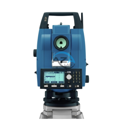
TOTAL STATION BUILDER AZA1029
AZA1029 Total Station Builder
The AZA1029 Total Station Builder is a high-precision digital surveying instrument engineered for construction layout, topographic surveying, and leveling applications. Combining an electronic theodolite, advanced EDM technology, and integrated survey software into a single rugged platform, AZA1029 delivers accuracy, efficiency, and reliability for demanding field environments.
Designed specifically for civil engineers, surveyors, and construction professionals, the AZA1029 ensures fast, repeatable, and highly accurate positioning across complex job sites.
