
 Rock
Rock Aggregate
 Cement
 Concrete
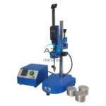 Soil
Soil Steel
Steel Bitumen/Asphalt
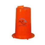 Security Survey Equipment
 General Items
")
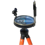
BRUNTON COMPASS AZA1042
The Brunton Compass AZA1042 from Azalab is a professional-grade field instrument engineered for high-precision geological mapping, structural analysis, environmental surveying, and navigation. Recognized globally as the industry benchmark, this compass is trusted by geologists, civil engineers, surveyors, archaeologists, researchers, and students working in demanding outdoor environments.
Unlike conventional handheld compasses, the Brunton Compass is a multi-functional surveying tool, integrating a magnetic compass, clinometer, protractor, and mirror sighting system into a single compact instrument. This versatility allows accurate measurement of azimuth, strike, dip, inclination, and slope angles, making it indispensable for scientific fieldwork.
Description
Precision Engineering & Accuracy
The AZA1042 features a precision-balanced magnetic needle with rapid settling time, delivering stable and reliable directional readings even in areas with mild magnetic interference. The manual declination adjustment mechanism allows users to compensate for local magnetic variation, ensuring true-north-referenced measurements — essential for professional mapping and survey accuracy.
Its integrated clinometer (±90°) enables precise measurement of vertical and inclined angles, making the compass ideal for structural geology, stratigraphy, fault analysis, mining exploration, and slope stability studies.
Mirror Sighting & Field Alignment
The built-in mirror sight and peep sight system allows simultaneous viewing of the compass needle and target object. This alignment method significantly improves bearing accuracy during triangulation, traverse surveys, and long-distance navigation.
Rugged Construction & Portability
Manufactured with a die-cast aluminum housing, the AZA1042 Brunton Compass is designed to withstand harsh weather, rough handling, and prolonged field exposure. Its compact form factor and lightweight design (200–300 g) make it easy to carry in a field vest, survey pouch, or backpack.
A tightly sealed lid protects internal components from dust and moisture, ensuring long-term reliability in rugged terrain.
Applications
-
Structural geology (strike & dip measurement)
-
Geological field mapping and stratigraphy
-
Mining and mineral exploration
-
Environmental and topographic surveying
-
Archaeological site mapping
-
Outdoor navigation and field training
-
Academic geology and civil engineering fieldwork
The AZA1042 is widely recommended by universities and research institutions as an essential field tool, often paired with geological hammers, field notebooks, and measuring tapes.
Specifications
| Feature | Specification |
|---|---|
| Model | AZA1042 |
| Compass Type | Magnetic with mirror sighting |
| Clinometer Range | ±90° |
| Declination Adjustment | Manual, ±180° |
| Housing Material | Die-cast aluminum |
| Needle Settling Time | < 5 seconds |
| Dimensions | Approx. 3.1″ × 2.8″ × 1.2″ |
| Weight | Approx. 200–300 g |
| Applications | Geology, surveying, mapping, navigation |
Frequently Asked Questions (FAQ)
Q1: What makes the Brunton Compass AZA1042 different from a regular compass?
It combines a magnetic compass, clinometer, protractor, and mirror sight in one device, enabling precise geological and surveying measurements.
Q2: Can it be used for hiking and navigation?
Yes. While designed for professional surveying, it is equally reliable for navigation and outdoor use.
Q3: How is strike and dip measured using this compass?
Place the flat base against the rock surface to align the strike, then use the clinometer to measure dip angle.
Q4: Is it waterproof?
It is weather-resistant and suitable for rugged environments but should be kept dry when not in use.
Q5: Is a protective case included?
Most kits include a padded protective case. Availability may vary by supply package.
Key Highlights
-
Precision magnetic needle with fast settling
-
Integrated clinometer for angle measurement
-
Adjustable declination for true-north accuracy
-
Mirror sighting system for precise alignment
-
Rugged aluminum body for field durability
-
Lightweight, compact, and shock-resistant
-
Ideal for geology, surveying, and academic fieldwork
Model: AZA1042 – Brunton Compass by Azalab
Additional information
| Compass Type |
Magnetic with mirror sighting |
|---|---|
| Clinometer Range |
±90° |
| Declination Adjustment |
Manual (±180° scale) |
| Housing Material |
Die-cast Aluminum |
You may also like…
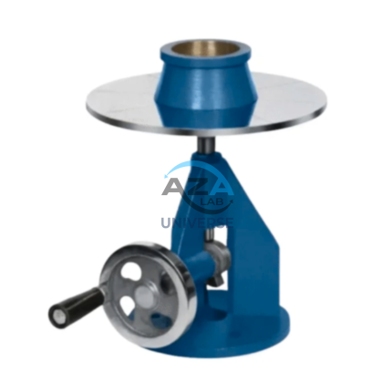
PARTICLE DENSITY BY GAS JAR METHOD (END-OVER-END SHAKER) AZA0885
The AZA0885 Particle Density Test Set from Azalab is a precision laboratory apparatus designed for determining the specific gravity (particle density) of fine-grained soils, particularly silts and clays. This method is especially effective where conventional pycnometer techniques may suffer from air entrapment or handling difficulties with cohesive soils.
The apparatus operates on the Gas Jar Method with an End-Over-End Shaker, a standardized and highly reliable procedure specified in IS 2720 (Part 3 / Section 1) and BS 1377. The controlled mechanical rotation ensures uniform suspension of soil particles, leading to accurate, repeatable, and operator-independent results.
Related products
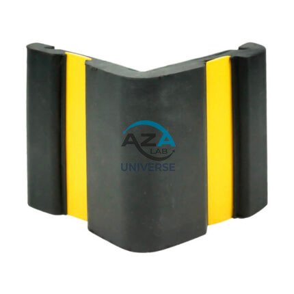
CORNER GUARD AZA1022
Wall & Edge Protection Solutions for Safety, Durability, and Aesthetics by Azalab
The AZA1022 Corner Guards are a practical, durable, and cost-effective solution for protecting wall edges and exposed corners from impact damage in both residential and commercial environments. Designed to prevent chipping, cracking, abrasion, and collision damage, these guards are especially essential in high-traffic areas where trolleys, carts, wheelchairs, forklifts, or vehicles are frequently in use.
Azalab’s AZA1022 range combines impact resistance, safety visibility, and clean aesthetics, ensuring long-term protection while maintaining the visual integrity of interior and exterior spaces.
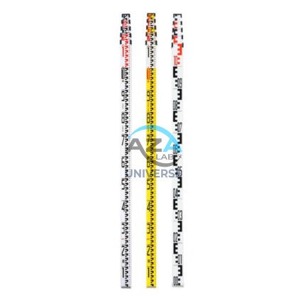
LEVELLING STAVES AZA1034
AZA1034 Levelling Staves (Survey Staff / Leveling Staff)
The AZA1034 Levelling Staff is an essential surveying accessory used in conjunction with dumpy levels, automatic levels, and digital levels to accurately measure height differences between ground points. Designed for reliability, visibility, and ease of handling, it is a critical tool for construction, civil engineering, and land surveying applications.
Accurate Elevation Measurement
Levelling staves provide a vertical reference that allows surveyors and engineers to determine elevation differences with precision. When viewed through an optical leveling instrument, the graduated scale on the AZA1034 enables clear and accurate readings, ensuring dependable height transfer across distances.
The staff is available with metric (cm/m) or imperial (ft/in) graduations, depending on project requirements.
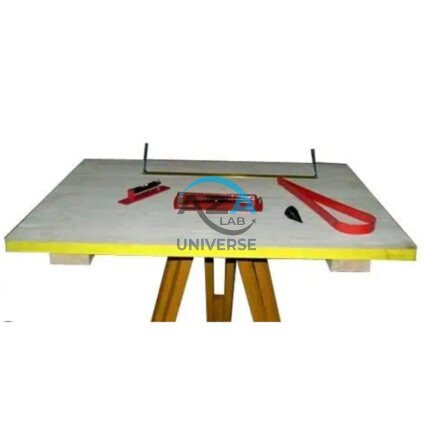
PLANE TABLE SET AZA1044
The Plane Table Set AZA1044 from Azalab is a classic and highly effective field surveying and mapping instrument used for topographic surveys, site layout, and civil engineering planning. Known for its simplicity, accuracy, and real-time plotting capability, this set is widely adopted by surveyors, civil engineers, geologists, architects, and engineering students for both professional and academic fieldwork.
Plane table surveying allows measurements and observations to be plotted directly onto paper at the survey site, eliminating transcription errors and significantly reducing post-field processing time. Unlike electronic instruments, this manual method provides a visual and intuitive understanding of terrain, making it especially valuable for education, reconnaissance surveys, and remote-area mapping.

PRISMATIC COMPASS AZA1043
The Prismatic Compass AZA1043 from Azalab is a professional-grade navigation and surveying instrument designed for land surveying, geological exploration, mapping, and field navigation. Built for accuracy, durability, and ease of use, this compass is widely relied upon by surveyors, geologists, civil engineers, military personnel, students, and outdoor professionals operating in diverse and challenging environments.
Unlike conventional magnetic compasses, the prismatic compass incorporates an optical prism system that allows the user to simultaneously sight a distant object and read the bearing. This unique feature significantly improves measurement accuracy, particularly for long-distance bearings, triangulation, and route alignment tasks

ROUND POST HOLE FORM AZA1020
Precision Cylindrical Concrete Formwork for Posts & Foundations by Azalab
The AZA1020 Round Post Hole Form is a high-performance cylindrical mold engineered for forming strong, uniform concrete footings for posts, poles, fences, and light structural foundations. Designed for both professional contractors and serious DIY users, this form ensures accuracy, speed, and consistency in concrete placement while minimizing material waste.
Ideal for fencing, decking, lighting poles, signposts, and temporary or permanent structures, the AZA1020 delivers clean finishes and dependable load-bearing performance.
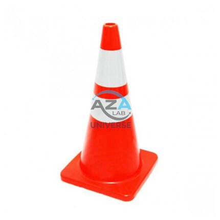
SAFETY CONE AZA1026
High-Visibility Traffic & Site Safety Cone by Azalab
The AZA1026 Safety Cone is a versatile and essential safety device used for traffic control, hazard marking, and area demarcation across construction sites, roads, laboratories, parking areas, and industrial facilities. Designed for maximum visibility, durability, and ease of handling, AZA1026 provides reliable performance in both indoor and outdoor environments.
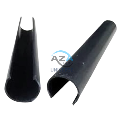
SCAFFOLD POLY CLIP AZA1019
Secure Fastening Solution for Debris Netting & Protective Mesh by Azalab
AZA1019 Scaffold Poly Clips are essential construction safety accessories designed for the secure fastening of debris netting, shade mesh, and protective sheeting to scaffolding structures. Engineered for durability, safety, and ease of use, these clips provide a tool-free, reusable, and weather-resistant fixing solution for construction and industrial sites.
Widely used by builders, safety officers, scaffolding contractors, and site supervisors, AZA1019 clips help improve site safety, dust control, and environmental protection at height.
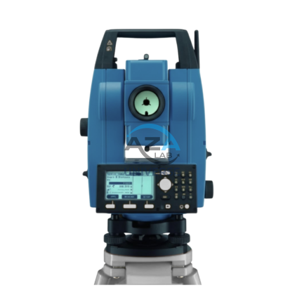
TOTAL STATION BUILDER AZA1029
AZA1029 Total Station Builder
The AZA1029 Total Station Builder is a high-precision digital surveying instrument engineered for construction layout, topographic surveying, and leveling applications. Combining an electronic theodolite, advanced EDM technology, and integrated survey software into a single rugged platform, AZA1029 delivers accuracy, efficiency, and reliability for demanding field environments.
Designed specifically for civil engineers, surveyors, and construction professionals, the AZA1029 ensures fast, repeatable, and highly accurate positioning across complex job sites.