
 Rock
Rock Aggregate
 Cement
 Concrete
 Soil
Soil Steel
Steel Bitumen/Asphalt
 Security Survey Equipment
 General Items
")
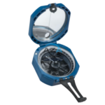
PRISMATIC COMPASS AZA1043
The Prismatic Compass AZA1043 from Azalab is a professional-grade navigation and surveying instrument designed for land surveying, geological exploration, mapping, and field navigation. Built for accuracy, durability, and ease of use, this compass is widely relied upon by surveyors, geologists, civil engineers, military personnel, students, and outdoor professionals operating in diverse and challenging environments.
Unlike conventional magnetic compasses, the prismatic compass incorporates an optical prism system that allows the user to simultaneously sight a distant object and read the bearing. This unique feature significantly improves measurement accuracy, particularly for long-distance bearings, triangulation, and route alignment tasks
Description
High-Precision Optical Design
The AZA1043 Prismatic Compass features a sighting slit with hairline, an adjustable optical prism, and a graduated bearing ring, enabling precise angular measurements without shifting the viewing position. Bearings are typically marked from 0° to 360° and may also include mil (mils/radians) graduations, making it suitable for civil, geological, and defense-related applications.
Its liquid-filled capsule dampens needle movement, ensuring rapid stabilization and steady readings even in windy conditions or uneven terrain. This feature is especially valuable during active field surveys where vibration and motion can otherwise affect accuracy.
Rugged Construction & Field Reliability
Constructed with a lightweight, corrosion-resistant metal body, the AZA1043 is engineered to withstand rough handling, outdoor exposure, and long-term field use. The protective hinged lid not only shields the compass when not in use but also functions as part of the sighting mechanism during operation.
Unlike electronic navigation tools, the prismatic compass operates entirely without batteries or power, ensuring dependable performance in remote areas where GPS signals or charging options are unavailable.
Ease of Use & Portability
Compact and ergonomic, the AZA1043 can be worn around the neck using the supplied lanyard or stored in a field pouch or backpack. Its intuitive mechanical design allows users to quickly develop proficiency in reading bearings, making it equally suitable for professionals, trainees, and students.
With minimal maintenance requirements, the compass only needs periodic cleaning and dry storage to maintain long-term accuracy.
Applications
-
Land and topographic surveying
-
Geological field mapping and exploration
-
Civil engineering alignment and layout
-
Military and paramilitary navigation
-
Hiking, trekking, and orienteering
-
Academic training in geography and earth sciences
-
Backup navigation where GPS is unreliable
Specifications
| Feature | Specification |
|---|---|
| Model | AZA1043 |
| Type | Prismatic Compass |
| Measurement Range | 0° to 360° (degrees), may include mils |
| Sighting Mechanism | Sighting slit with hairline |
| Prism | Adjustable optical prism |
| Liquid Damping | Yes (liquid-filled capsule) |
| Body Material | Metal, anti-corrosion finish |
| Weight | Approx. 200–300 g |
| Markings | Graduated ring (degrees / mils) |
| Accessories | Neck lanyard, protective case |
| Applications | Surveying, navigation, geology, education |
Frequently Asked Questions (FAQ)
Q1: What is the main purpose of the Prismatic Compass AZA1043?
It is used to measure horizontal angles and bearings accurately in surveying, geological mapping, and navigation.
Q2: Is this compass suitable for hiking and outdoor navigation?
Yes. It is widely used for hiking, trekking, and adventure navigation due to its accuracy and reliability.
Q3: Does the compass require batteries or power?
No. It is a fully mechanical instrument and operates without electricity.
Q4: How accurate is a prismatic compass compared to a standard compass?
A prismatic compass offers significantly higher accuracy because it allows simultaneous sighting and reading through the prism.
Q5: What makes this compass suitable for professional use?
Its optical prism, liquid damping, rugged metal construction, and precise graduations make it ideal for professional fieldwork.
Key Highlights
-
High-precision prismatic compass for field use
-
Optical prism for accurate, real-time bearing readings
-
Sighting slit with hairline for precise alignment
-
Liquid-filled capsule for stable needle movement
-
Lightweight metal body with protective lid
-
Graduated in degrees and mils
-
No batteries required — reliable in all environments
-
Used by engineers, surveyors, geologists, and outdoor professionals
Model: AZA1043 – Prismatic Compass by Azalab
Additional information
| Type |
Prismatic Compass |
|---|---|
| Measurement Range |
0° to 360° (degrees); may include mils |
| Sighting Mechanism |
Sighting slit with hairline |
| Prism |
Adjustable optical prism for reading |
You may also like…
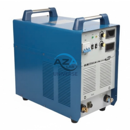
ARC WELDING MACHINE AZA1234
The AZA1234 Arc Welding Machine by A Z A Lab is a high-performance industrial welding solution engineered for demanding fabrication, maintenance, and structural welding applications. Designed using advanced inverter technology, this machine delivers superior arc stability, high efficiency, and reliable welding performance across a wide range of electrode types and materials.
With an inverter frequency of up to 20 kHz, the AZA1234 ensures fast dynamic response, reduced spatter, and excellent weld bead appearance. Its robust electrical design supports a high duty cycle, allowing continuous operation under heavy loads while maintaining consistent welding output—even with output cable lengths of up to 100 meters.
AUTODIST-86 GLASS DISTILLATION UNITAZA1282
The AutoDist-86 Glass Distillation Unit (Model AZA1282) is a high-performance laboratory water distiller designed for the continuous production of high-purity distilled water.
Constructed entirely from borosilicate glass 3.3, the unit ensures zero metallic contamination, excellent thermal resistance, and long operational life. It is ideal for laboratories requiring consistent, low-conductivity distilled water for analytical, pharmaceutical, and research applications.Distillation Performance
- Distillate Output: Up to 4 L/hour (±10%)
- Suitable for routine and medium-scale laboratory demand
- Efficient removal of:
- Dissolved salts
- Heavy metals
- Organic/inorganic impurities
- Microbial contaminants
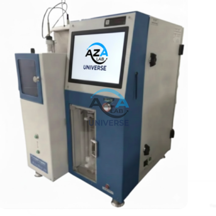
AUTOMATED CLEVELAND OPEN CUP FLASH & FIRE POINT ANALYZER AZA1276
The AutoFlash1276 (Model: AZA1276) from AZA Lab is a fully automated, microcontroller-based Cleveland Open Cup (COC) Flash and Fire Point Analyzer designed for high-temperature petroleum testing applications. Engineered for accuracy, safety, and regulatory compliance, the AZA1276 delivers reliable flash and fire point determination for materials with flash points above 79 °C up to 400 °C.
Complying with ASTM D92, ISO 2592, IS 1448 (Part 69), and IP 36, this advanced analyzer is ideal for laboratories and industrial environments where repeatability, operator safety, and international acceptance are critical.

BRUNTON COMPASS AZA1042
The Brunton Compass AZA1042 from Azalab is a professional-grade field instrument engineered for high-precision geological mapping, structural analysis, environmental surveying, and navigation. Recognized globally as the industry benchmark, this compass is trusted by geologists, civil engineers, surveyors, archaeologists, researchers, and students working in demanding outdoor environments.
Unlike conventional handheld compasses, the Brunton Compass is a multi-functional surveying tool, integrating a magnetic compass, clinometer, protractor, and mirror sighting system into a single compact instrument. This versatility allows accurate measurement of azimuth, strike, dip, inclination, and slope angles, making it indispensable for scientific fieldwork.
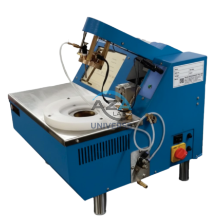
CLEVELAND OPEN-CUP FLASH & FIRE POINT TESTER AZA1292
The Cleveland Open Cup Flash Point Tester AZA1292 from AZA Lab is a reliable and precision-engineered laboratory instrument designed for determining the flash point and fire point of petroleum products in strict accordance with ASTM D92 and GB/T 3536-2008 standards. Engineered for accuracy, safety, and operational simplicity, the AZA1292 is an ideal solution for petroleum laboratories, refineries, inspection agencies, and quality control departments.
The instrument is suitable for testing petroleum products with flash points in the range of 79°C to 400°C, excluding fuel oils, and delivers consistent, repeatable, and standards-compliant results.
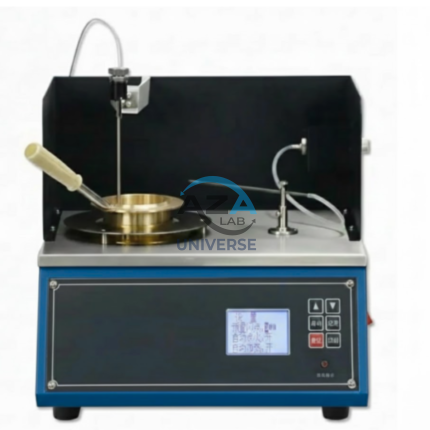
PENSKY–MARTENS CLOSED CUP FLASH POINT TESTER AZA1278
The AZA1278 Pensky–Martens Closed Cup Flash Point Tester is a high-precision, microcomputer-controlled instrument designed for accurate determination of flash points of petroleum products under controlled conditions.
Fully compliant with ASTM D93, the system supports Procedures A, B, and C, making it suitable for a wide range of fuels, lubricants, and viscous petroleum samples. It is engineered for reliability, repeatability, and safe laboratory operation.
Standards Compliance
- ASTM D93 (Pensky–Martens Closed Cup)
Related products
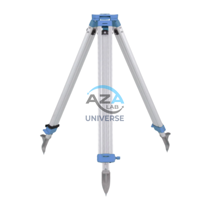
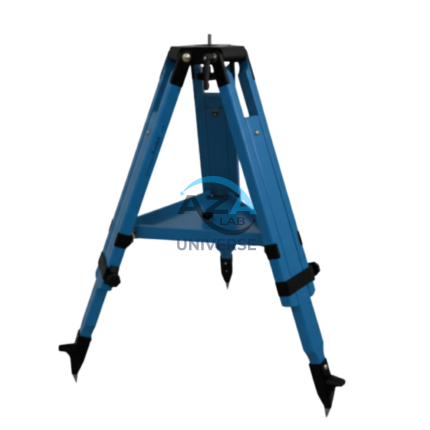
ALUMINUM TRIPOD AZA1037
AZA1037 Aluminum Tripod (Surveying & Construction Instrument Stand)
The AZA1037 Aluminum Tripod from Azalab is a high-precision, field-ready instrument stand engineered to provide maximum stability, portability, and durability for professional surveying and construction applications. It serves as a reliable mounting platform for auto levels, total stations, theodolites, rotary lasers, and mapping instruments, ensuring accurate measurements in demanding site conditions.
Lightweight & Corrosion-Resistant Construction
Manufactured from high-grade anodized aluminum alloy, the AZA1037 tripod offers an optimal balance between strength and weight. The corrosion-resistant finish makes it suitable for prolonged outdoor use, including dusty construction sites, uneven terrain, and damp environments, without compromising structural integrity or performance.
Despite its robust construction, the tripod remains lightweight, allowing easy handling and transportation between job locations.
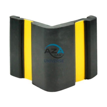
CORNER GUARD AZA1022
Wall & Edge Protection Solutions for Safety, Durability, and Aesthetics by Azalab
The AZA1022 Corner Guards are a practical, durable, and cost-effective solution for protecting wall edges and exposed corners from impact damage in both residential and commercial environments. Designed to prevent chipping, cracking, abrasion, and collision damage, these guards are especially essential in high-traffic areas where trolleys, carts, wheelchairs, forklifts, or vehicles are frequently in use.
Azalab’s AZA1022 range combines impact resistance, safety visibility, and clean aesthetics, ensuring long-term protection while maintaining the visual integrity of interior and exterior spaces.
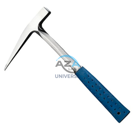
GEOLOGICAL HAMMER AZA1041
The Geological Hammer AZA1041 from Azalab is a robust, professional-grade field tool designed for rock sampling, mineral identification, fossil extraction, and geological exploration. It is an essential instrument for geologists, earth science students, archaeologists, mining professionals, and fossil enthusiasts, offering exceptional strength, balance, and reliability in demanding field conditions.
Engineered for rugged outdoor use, the hammer features a forged one-piece, heat-treated high-carbon steel head, ensuring superior impact resistance, long service life, and safety during repeated strikes. Unlike welded or cast alternatives, the forged construction prevents head separation and deformation, even when used on hard igneous or metamorphic rocks.
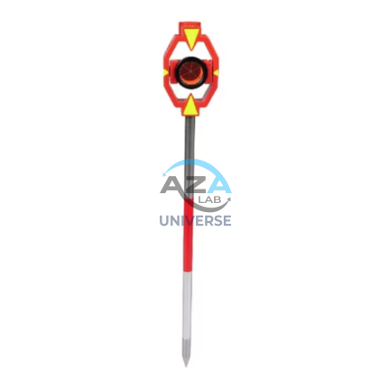
PRISM WITH POLE AZA1036
High-Precision Reflector for EDM Measurements
At the core of the AZA1036 is a single retroreflective survey prism, manufactured from high-purity optical glass and silver-coated for maximum signal return. The prism efficiently reflects the EDM signal back to the total station, enabling accurate distance measurement over long ranges—up to 2,000 meters, depending on instrument capability and site conditions. The prism is housed in a rugged protective casing and mounted on a high-visibility target plate, allowing easy acquisition through the telescope even in low-light, foggy, or dusty environments.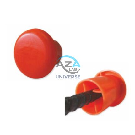
PROTECTIVE CAPS FOR REBAR, PIPE, BOLTS AZA1024
Multi-Purpose Safety Caps for Rebar, Pipes & Threaded Components by Azalab
AZA1024 Protective Caps are heavy-duty safety and maintenance accessories designed to protect workers, equipment, and materials on construction sites, industrial facilities, and fabrication yards. Engineered for injury prevention, corrosion protection, and regulatory compliance, these caps provide a simple yet highly effective solution for covering exposed rebars, pipe ends, bolts, and threaded rods.
Azalab’s AZA1024 range combines high visibility, impact resistance, and weather durability, making it suitable for demanding site conditions across residential, commercial, and infrastructure projects.
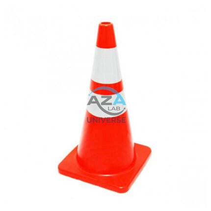
SAFETY CONE AZA1026
High-Visibility Traffic & Site Safety Cone by Azalab
The AZA1026 Safety Cone is a versatile and essential safety device used for traffic control, hazard marking, and area demarcation across construction sites, roads, laboratories, parking areas, and industrial facilities. Designed for maximum visibility, durability, and ease of handling, AZA1026 provides reliable performance in both indoor and outdoor environments.
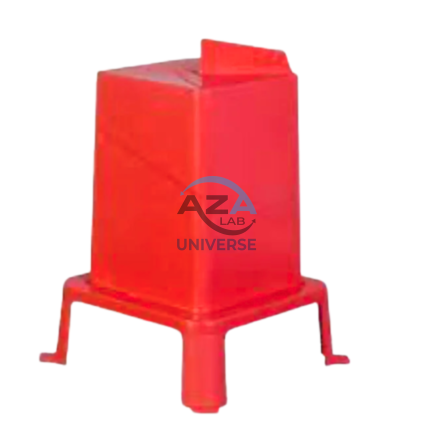
SQUARE HOLE FORM AZA1021
Precision Square Concrete Footing Mold for Posts & Structural Bases by Azalab
The AZA1021 Square Hole Form is a rigid, pre-engineered concrete mold designed for forming accurate square foundations for posts, pillars, fencing systems, signage, decks, and structural columns. Engineered for speed, precision, and consistency, this form is ideal for residential, commercial, and infrastructure projects where square geometry and sharp edges are structurally or aesthetically required.
Available from Azalab, the AZA1021 enables contractors, landscapers, and builders to pour concrete footings cleanly and efficiently while reducing labor time and material waste.
WOODEN TRIPOD AZA1038
Superior Stability with Natural Vibration Dampening
Unlike aluminum tripods, wooden tripods provide natural vibration absorption, making them the preferred choice for total stations, theodolites, laser scanners, and auto levels—especially for long-distance and high-accuracy measurements. The AZA1038 is manufactured from seasoned hardwood, carefully selected and treated to resist moisture, warping, and deformation, ensuring consistent performance in both dry and humid environments