
 Rock
Rock Aggregate
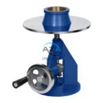 Cement
 Concrete
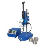 Soil
Soil Steel
Steel Bitumen/Asphalt
 Security Survey Equipment
 General Items
")
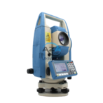
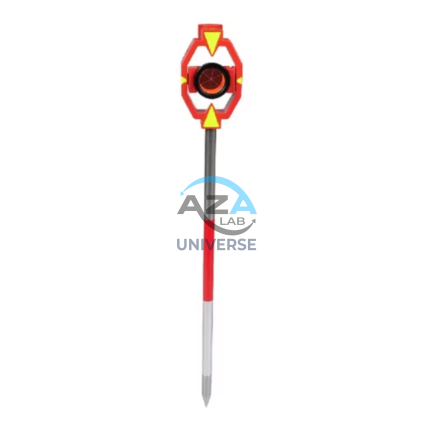
ELECTRONIC THEODOLITE AZA1027
Precision Redefined for Field Surveying
The AZA1027 is an essential instrument for topographic surveys, construction layout, and structural alignment. Equipped with high-resolution angle encoders, it significantly reduces reading errors and ensures consistent measurement accuracy.
An integrated optical plummet and dual-axis compensator allow reliable operation even on uneven terrain. With angular accuracy ranging from ±2″ to ±5″ seconds (model dependent), the AZA1027 is ideal for projects requiring tight tolerances such as bridges, tunnels, and high-rise structures.
Description
Intuitive Digital Interface
Unlike conventional optical theodolites, the AZA1027 features a digital LCD display that presents real-time angle readings clearly and directly.
Interface highlights:
-
Dual-side backlit LCD displays for convenient viewing
-
Soft-touch keypad for easy configuration
-
Zero-set and hold functions for repetitive measurements
-
Battery status indication for uninterrupted fieldwork
The intuitive interface makes the AZA1027 suitable for both experienced surveyors and educational institutions.
Rugged & Field-Ready Construction
Built for harsh environments, the AZA1027 features a dust-proof and splash-resistant housing (IP54 or higher). Its compact and lightweight design ensures easy transportation without compromising stability or performance.
The instrument maintains calibration and accuracy across construction sites, mining areas, dusty zones, and remote field locations.
Wide Range of Applications
The AZA1027 Electronic Theodolite is widely used in:
-
Civil engineering layout works
-
Building and structural alignment
-
Topographic and land surveys
-
Road, railway, and bridge construction
-
Mining and tunneling projects
-
Academic and training laboratories
Battery & Data Storage
The instrument is powered by a rechargeable battery pack, providing up to 16–20 hours of continuous operation. Internal memory enables storage of multiple observation sets, which can be transferred to a PC via data cable or optional Bluetooth (model dependent).
This ensures efficient documentation and data management for long survey sessions.
Calibration & Compliance
Each AZA1027 unit is factory calibrated and complies with:
-
ISO / IEC 17025 calibration practices
-
BIS measurement instrument guidelines
-
Survey of India & RITES project requirements
Technical Specifications – AZA1027
| Feature | Specification |
|---|---|
| Angle Measurement Accuracy | ±2″ to ±5″ seconds |
| Display | Dual-side digital LCD |
| Telescope Magnification | 30× or higher |
| Minimum Reading | 1″ or 5″ |
| Compensator | Dual-axis (automatic / manual) |
| Data Storage | Internal memory |
| Battery Type | Rechargeable Ni-MH / Li-ion |
| Operating Time | Up to 20 hours |
| Dust & Water Protection | IP54 or above |
| Tripod Mount | Standard 5/8″ thread |
Key Advantages of AZA1027
-
Accurate horizontal and vertical angle measurement
-
Digital display with user-friendly controls
-
High-resolution encoder technology
-
Internal memory for observation storage
-
Lightweight, rugged, and field-ready design
-
Ideal for surveying, civil engineering, and academic labs
Frequently Asked Questions (FAQ)
Q1: What is the primary use of AZA1027?
A: It is used for precise horizontal and vertical angle measurement in surveying and construction works.
Q2: Is the display readable in bright sunlight?
A: Yes, the backlit LCD provides excellent visibility in all lighting conditions.
Q3: Can data be stored and exported?
A: Yes, internal memory and data transfer options are available.
Q4: Is frequent calibration required?
A: No. Periodic calibration is recommended, not before every use.
Q5: Is AZA1027 suitable for educational institutions?
A: Yes, it is widely used in engineering and surveying laboratories.
Additional information
| Angle Measurement Accuracy |
±2" to ±5" seconds (depending on model) |
|---|---|
| Display |
Dual-side digital LCD |
| Telescope Magnification |
30x or higher |
| Minimum Reading |
1" or 5" |
You may also like…

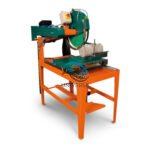
JOLTING APPARATUS AZA0802
The AZA0802 Jolting Apparatus is a precision-engineered laboratory instrument designed for uniform compaction of cement mortar specimens, ensuring reproducibility and accuracy in strength testing. It plays a vital role in preparing mortar prisms for compressive and flexural strength tests, eliminating air voids and ensuring homogeneous density throughout each specimen.
Manufactured in accordance with IS 10080:1982, and suitable for use under EN 196-1 and ASTM C348 testing standards, the AZA0802 is essential for any laboratory involved in cement quality evaluation, research, or certification.
Whether used in construction QC labs, cement manufacturing units, academic institutions, or R&D centers, the AZA0802 offers dependable, consistent, and safe compaction performance for standardized mortar testing.

PRISM MOULD THREE GANG AZA0803
- Triple-cavity unit for mortar sample casting
- Ideal for compressive/flexural testing
- IS/EN-compliant precision mould
- Lab-grade cast iron build
- Smooth de-moulding and cleaning
Related products
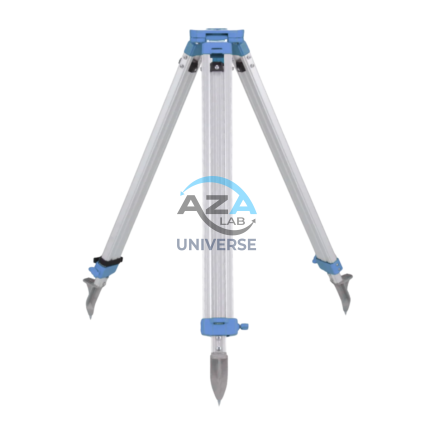
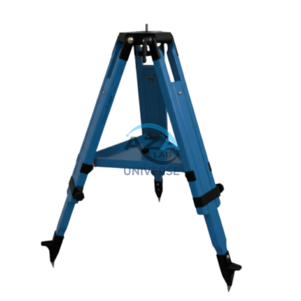
ALUMINUM TRIPOD AZA1037
AZA1037 Aluminum Tripod (Surveying & Construction Instrument Stand)
The AZA1037 Aluminum Tripod from Azalab is a high-precision, field-ready instrument stand engineered to provide maximum stability, portability, and durability for professional surveying and construction applications. It serves as a reliable mounting platform for auto levels, total stations, theodolites, rotary lasers, and mapping instruments, ensuring accurate measurements in demanding site conditions.
Lightweight & Corrosion-Resistant Construction
Manufactured from high-grade anodized aluminum alloy, the AZA1037 tripod offers an optimal balance between strength and weight. The corrosion-resistant finish makes it suitable for prolonged outdoor use, including dusty construction sites, uneven terrain, and damp environments, without compromising structural integrity or performance.
Despite its robust construction, the tripod remains lightweight, allowing easy handling and transportation between job locations.
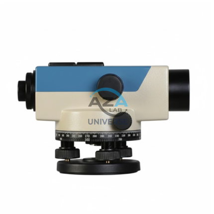
AUTOMATIC LEVEL AZA1033
AZA1033 Automatic Level (Auto Level / Self-Leveling Optical Level)
The AZA1033 Automatic Level is a high-precision optical surveying instrument engineered for accurate elevation measurement in construction, roadwork, and civil engineering projects. Designed to establish and verify horizontal planes over long distances, it is an essential tool for engineers, surveyors, and site supervisors who require speed, stability, and dependable accuracy.
Self-Leveling Accuracy with Built-in Compensator
Unlike manual leveling instruments, the AZA1033 features a self-leveling compensator system that automatically maintains a true horizontal line of sight. Once roughly leveled using the circular bubble vial, the internal compensator corrects minor tilts and vibrations instantly.
This mechanism significantly reduces setup time, eliminates operator error, and ensures stable readings even on uneven ground or vibration-prone sites
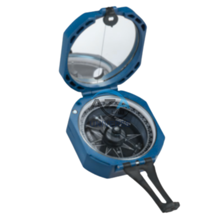
BRUNTON COMPASS AZA1042
The Brunton Compass AZA1042 from Azalab is a professional-grade field instrument engineered for high-precision geological mapping, structural analysis, environmental surveying, and navigation. Recognized globally as the industry benchmark, this compass is trusted by geologists, civil engineers, surveyors, archaeologists, researchers, and students working in demanding outdoor environments.
Unlike conventional handheld compasses, the Brunton Compass is a multi-functional surveying tool, integrating a magnetic compass, clinometer, protractor, and mirror sighting system into a single compact instrument. This versatility allows accurate measurement of azimuth, strike, dip, inclination, and slope angles, making it indispensable for scientific fieldwork.
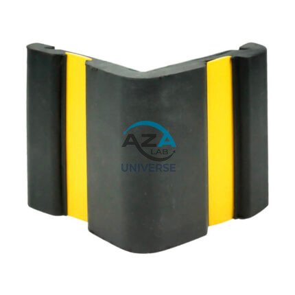
CORNER GUARD AZA1022
Wall & Edge Protection Solutions for Safety, Durability, and Aesthetics by Azalab
The AZA1022 Corner Guards are a practical, durable, and cost-effective solution for protecting wall edges and exposed corners from impact damage in both residential and commercial environments. Designed to prevent chipping, cracking, abrasion, and collision damage, these guards are especially essential in high-traffic areas where trolleys, carts, wheelchairs, forklifts, or vehicles are frequently in use.
Azalab’s AZA1022 range combines impact resistance, safety visibility, and clean aesthetics, ensuring long-term protection while maintaining the visual integrity of interior and exterior spaces.
PRISM WITH POLE AZA1036
High-Precision Reflector for EDM Measurements
At the core of the AZA1036 is a single retroreflective survey prism, manufactured from high-purity optical glass and silver-coated for maximum signal return. The prism efficiently reflects the EDM signal back to the total station, enabling accurate distance measurement over long ranges—up to 2,000 meters, depending on instrument capability and site conditions. The prism is housed in a rugged protective casing and mounted on a high-visibility target plate, allowing easy acquisition through the telescope even in low-light, foggy, or dusty environments.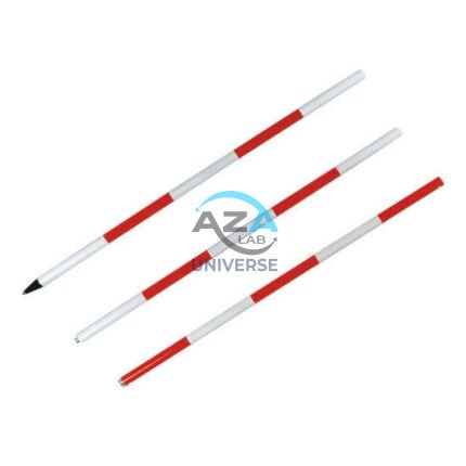
RANGE POLE AZA1035
Reliable Vertical Reference for Surveying & GNSS
Range poles play a critical role in establishing line-of-sight alignment, boundary marking, control point positioning, and coordinate measurement. The AZA1035 ensures the mounted instrument or target remains vertically aligned, minimizing positional and height errors during data capture. This makes it an essential tool for surveyors, civil engineers, and GIS professionals working in both urban and remote field conditions.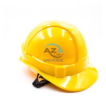
SAFETY HELMET AZA1025
Industrial & Laboratory Head Protection Helmet by Azalab
The AZA1025 Safety Helmet is a critical component of personal protective equipment (PPE), engineered to deliver reliable head protection, long-wearing comfort, and certified safety compliance across construction, industrial, laboratory, and infrastructure environments.
Designed using advanced materials and ergonomic principles, AZA1025 ensures maximum protection against falling objects, accidental impacts, and workplace hazards while remaining lightweight and comfortable for extended use.
WOODEN TRIPOD AZA1038
Superior Stability with Natural Vibration Dampening
Unlike aluminum tripods, wooden tripods provide natural vibration absorption, making them the preferred choice for total stations, theodolites, laser scanners, and auto levels—especially for long-distance and high-accuracy measurements. The AZA1038 is manufactured from seasoned hardwood, carefully selected and treated to resist moisture, warping, and deformation, ensuring consistent performance in both dry and humid environments