
 Rock
Rock Aggregate
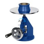 Cement
 Concrete
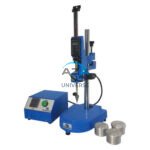 Soil
Soil Steel
Steel Bitumen/Asphalt
 Security Survey Equipment
 General Items
")
LASER DISTANCE METER AZA1030
AZA1030 Laser Distance Meter
The AZA1030 Laser Distance Meter is a compact, high-precision digital measuring instrument designed for fast, accurate, and efficient distance measurement across construction, interior design, surveying, and real estate applications. Replacing conventional tape measures, the AZA1030 delivers instant results at the push of a button while significantly reducing manual errors and site time.
Fast & Accurate Digital Measurement
Powered by advanced laser diode technology, the AZA1030 provides measurement accuracy up to ±1.5 mm, with model-dependent measuring ranges extending up to 100 meters. It supports multiple measuring functions, enabling professionals to capture complex dimensions quickly and reliably.
Measurement capabilities include:
-
Single and continuous distance measurement
-
Area and volume calculation
-
Indirect height and distance measurement (Pythagorean mode)
-
Minimum / maximum tracking
This makes AZA1030 ideal for layout planning, verification, and space assessment.
Description
Compact, Handheld & User-Friendly
The AZA1030 features a slim, pocket-sized design, making it easy to carry on a toolbelt or in a pocket. A backlit LCD display with large digits ensures clear visibility in low-light indoor environments as well as bright outdoor conditions.
User interface highlights:
-
Simple one-button operation
-
Multiple measuring modes
-
Unit conversion (meters, feet, inches)
-
Front and rear reference measurement options
These features ensure effortless operation for both professionals and first-time users.
Versatile Applications
The AZA1030 Laser Distance Meter is widely used for:
-
Construction site layout and verification
-
Room measurement and interior planning
-
Architectural and real estate assessments
-
Surveying and field distance checks
-
HVAC, plumbing, and electrical installations
Its speed and accuracy make it an essential daily tool across multiple trades.
Data Storage & Smart Features
The instrument includes internal memory for storing 20–50 measurements, allowing users to record and recall readings easily during multi-room or multi-site work.
Select variants offer:
-
Bluetooth connectivity for smartphone app integration
-
Digital floor plan creation and documentation
-
Data syncing to mobile devices or cloud platforms
Long Battery Life & Efficient Power Management
The AZA1030 is available with rechargeable lithium-ion or AAA battery options, delivering 3,000+ measurements per charge. An automatic power-off function conserves energy during idle periods, ensuring extended field operation.
Rugged, Site-Ready Construction
Designed for demanding environments, the AZA1030 features:
-
IP54 / IP65 dust and splash resistance
-
Impact-resistant housing
-
Rubberized, non-slip grip for secure handling
Optional ¼-inch tripod mounting (model-dependent) allows stable setup for long-distance or vertical measurements.
Technical Specifications – AZA1030
| Feature | Specification |
|---|---|
| Measuring Range | 0.05 to 100 m (model-dependent) |
| Accuracy | ±1.5 mm |
| Measurement Functions | Distance, Area, Volume, Pythagorean |
| Display | Backlit LCD with large digits |
| Units Supported | Meters, Feet, Inches |
| Battery Type | Rechargeable Li-ion or AAA |
| Memory | 20–50 stored measurements |
| IP Rating | IP54 / IP65 (dust & water-resistant) |
| Connectivity (Optional) | Bluetooth |
| Tripod Mount | ¼-inch thread (select models) |
Key Advantages of AZA1030
-
Instant digital measurement up to 100 meters
-
High accuracy of ±1.5 mm
-
Measures distance, area, volume, and indirect height
-
Clear backlit LCD for indoor and outdoor use
-
Compact, lightweight, and pocket-sized
-
Rechargeable with long battery life
-
Internal memory for stored readings
-
Durable, dustproof, and splash-resistant design
Frequently Asked Questions (FAQ)
Q1: How accurate is the AZA1030?
A: It offers ±1.5 mm accuracy, suitable for professional applications.
Q2: Can it be used outdoors?
A: Yes. With a high-visibility laser and IP-rated protection, it performs well outdoors. A target plate is recommended in bright sunlight.
Q3: Does it calculate area and volume automatically?
A: Yes. Area and volume are calculated from two or three measurements.
Q4: Is calibration required?
A: Periodic calibration is recommended, especially after drops or prolonged outdoor use.
Q5: Can readings be transferred to a smartphone?
A: Yes, Bluetooth-enabled variants support mobile app integration.
Additional information
| Measuring Range |
0.05 to 100 meters (model-dependent) |
|---|---|
| Accuracy |
±1.5 mm |
| Functions |
Distance, Area, Volume, Pythagorean |
| Display |
Backlit LCD with large digits |
Related products
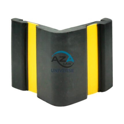
CORNER GUARD AZA1022
Wall & Edge Protection Solutions for Safety, Durability, and Aesthetics by Azalab
The AZA1022 Corner Guards are a practical, durable, and cost-effective solution for protecting wall edges and exposed corners from impact damage in both residential and commercial environments. Designed to prevent chipping, cracking, abrasion, and collision damage, these guards are especially essential in high-traffic areas where trolleys, carts, wheelchairs, forklifts, or vehicles are frequently in use.
Azalab’s AZA1022 range combines impact resistance, safety visibility, and clean aesthetics, ensuring long-term protection while maintaining the visual integrity of interior and exterior spaces.
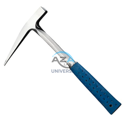
GEOLOGICAL HAMMER AZA1041
The Geological Hammer AZA1041 from Azalab is a robust, professional-grade field tool designed for rock sampling, mineral identification, fossil extraction, and geological exploration. It is an essential instrument for geologists, earth science students, archaeologists, mining professionals, and fossil enthusiasts, offering exceptional strength, balance, and reliability in demanding field conditions.
Engineered for rugged outdoor use, the hammer features a forged one-piece, heat-treated high-carbon steel head, ensuring superior impact resistance, long service life, and safety during repeated strikes. Unlike welded or cast alternatives, the forged construction prevents head separation and deformation, even when used on hard igneous or metamorphic rocks.
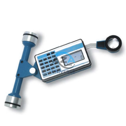
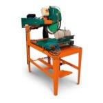
PLANIMETER AZA1040
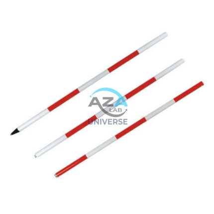
PRISM WITH POLE AZA1036
High-Precision Reflector for EDM Measurements
At the core of the AZA1036 is a single retroreflective survey prism, manufactured from high-purity optical glass and silver-coated for maximum signal return. The prism efficiently reflects the EDM signal back to the total station, enabling accurate distance measurement over long ranges—up to 2,000 meters, depending on instrument capability and site conditions. The prism is housed in a rugged protective casing and mounted on a high-visibility target plate, allowing easy acquisition through the telescope even in low-light, foggy, or dusty environments.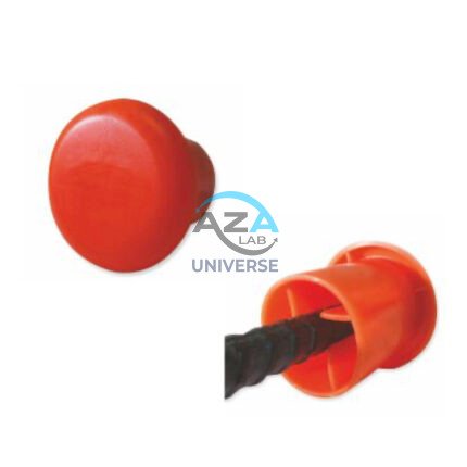
PROTECTIVE CAPS FOR REBAR, PIPE, BOLTS AZA1024
Multi-Purpose Safety Caps for Rebar, Pipes & Threaded Components by Azalab
AZA1024 Protective Caps are heavy-duty safety and maintenance accessories designed to protect workers, equipment, and materials on construction sites, industrial facilities, and fabrication yards. Engineered for injury prevention, corrosion protection, and regulatory compliance, these caps provide a simple yet highly effective solution for covering exposed rebars, pipe ends, bolts, and threaded rods.
Azalab’s AZA1024 range combines high visibility, impact resistance, and weather durability, making it suitable for demanding site conditions across residential, commercial, and infrastructure projects.
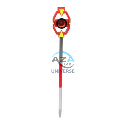
RANGE POLE AZA1035
Reliable Vertical Reference for Surveying & GNSS
Range poles play a critical role in establishing line-of-sight alignment, boundary marking, control point positioning, and coordinate measurement. The AZA1035 ensures the mounted instrument or target remains vertically aligned, minimizing positional and height errors during data capture. This makes it an essential tool for surveyors, civil engineers, and GIS professionals working in both urban and remote field conditions.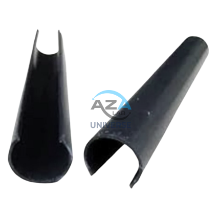
SCAFFOLD POLY CLIP AZA1019
Secure Fastening Solution for Debris Netting & Protective Mesh by Azalab
AZA1019 Scaffold Poly Clips are essential construction safety accessories designed for the secure fastening of debris netting, shade mesh, and protective sheeting to scaffolding structures. Engineered for durability, safety, and ease of use, these clips provide a tool-free, reusable, and weather-resistant fixing solution for construction and industrial sites.
Widely used by builders, safety officers, scaffolding contractors, and site supervisors, AZA1019 clips help improve site safety, dust control, and environmental protection at height.
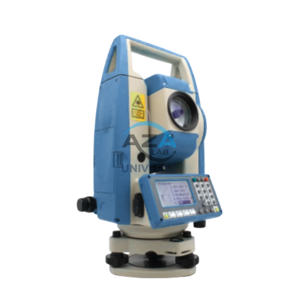
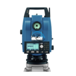
TOTAL STATION AZA1028
AZA1028 Total Station
The AZA1028 Total Station is a high-performance, all-in-one surveying instrument that integrates an electronic theodolite, electronic distance measurement (EDM), and advanced data recording into a single, robust platform. Designed for precision, efficiency, and durability, AZA1028 is an indispensable solution for civil engineers, construction professionals, land surveyors, and GIS specialists.